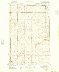
1949 Map of Northgate
USGS Topo · Published 1949About this map
The international border between Canada and the United States defines the northern edge of this North Dakota landscape, where the prairie meets the Canadian province of Saskatchewan. At the heart of the region's transport network is Northgate, a border settlement situated where the Great Northern and Soo Line railroads converge. This post-war survey illustrates a highly organized agricultural grid, with rural education centers like School No 1 and School No 2 serving the dispersed farmsteads of the prairie townships. The topography is shaped by glacial depressions and the seasonal flow of Stony Creek Run, which meanders through the southern sections. This document captures the peak of the small-town rail economy before the consolidation of rural services, providing an exact look at the siding at Perella and the intricate network of section-line roads that bound the grain-growing heartland of Burke County.
Find a feature on this map
13 named features on this map. Tap any name to fly to it.
Don’t see what you’re looking for? This feature index may not catch every label — zoom into the map to look around manually.
Map Details
Editions of this 1949 Northgate Map
This is the sole edition of this map. No revisions or reprints were ever made.
Other maps of this area

1947 · Bowbells NW
USGS Topo · 1:24,000

1947 · Flaxton
USGS Topo · 1:24,000

1947 · Bowbells
USGS Topo · 1:24,000

1948 · Flaxton
USGS Topo · 1:24,000

1948 · Coteau
USGS Topo · 1:24,000

1948 · Woburn
USGS Topo · 1:24,000

1949 · Bowbells
USGS Topo · 1:24,000

1949 · Bowbells NW
USGS Topo · 1:24,000

1950 · Bowbells
USGS Topo · 1:62,500

1950 · Flaxton
USGS Topo · 1:62,500