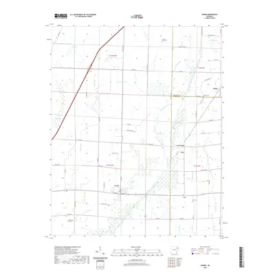
2020 Map of Grubbs
USGS Topo · Published 2020About this map
Grubbs sits at the intersection of a complex water management system in northeastern Arkansas, where the Cache River and its Old Channel wind through a landscape defined by drainage and agriculture. The reliance on water control is evident in the numerous engineered waterways like Gum Pond Ditch, Tiger Ditch, and Skillet Ditch, which redirect flow across the flat terrain. This map reveals a network of rural settlements including Uno, Pitts, and North Pitts, each connected by a grid of county roads such as Rockwright Rd and Chilson Rd. Genealogists will find significant value in the documentation of local burial grounds, including Denton Island Cem, Hankins-Sullins Cem, and Clark Cem. The persistence of these small communities and family-named landmarks, alongside natural features like Hale Lake and Tupelo Slough, highlights the enduring rural character of this region where Jackson, Craighead, and Poinsett counties meet.
Find a feature on this map
66 named features on this map. Tap any name to fly to it.
Don’t see what you’re looking for? This feature index may not catch every label — zoom into the map to look around manually.
Map Details
Editions of this 2020 Grubbs Map
This is the sole edition of this map. No revisions or reprints were ever made.
Other maps of this area

1935 · Sedgwick
USGS Topo · 1:62,500

1935 · Alicia
USGS Topo · 1:62,500

1935 · Tuckerman
USGS Topo · 1:62,500

1939 · Weiner
USGS Topo · 1:62,500

1953 · Memphis
USGS Topo · 1:250,000

1956 · Memphis
USGS Topo · 1:250,000

1959 · Weiner
USGS Topo · 1:62,500

1959 · Sedgwick
USGS Topo · 1:62,500

1960 · Weiner
USGS Topo · 1:62,500
1960 · Sedgwick
USGS Topo · 1:62,500