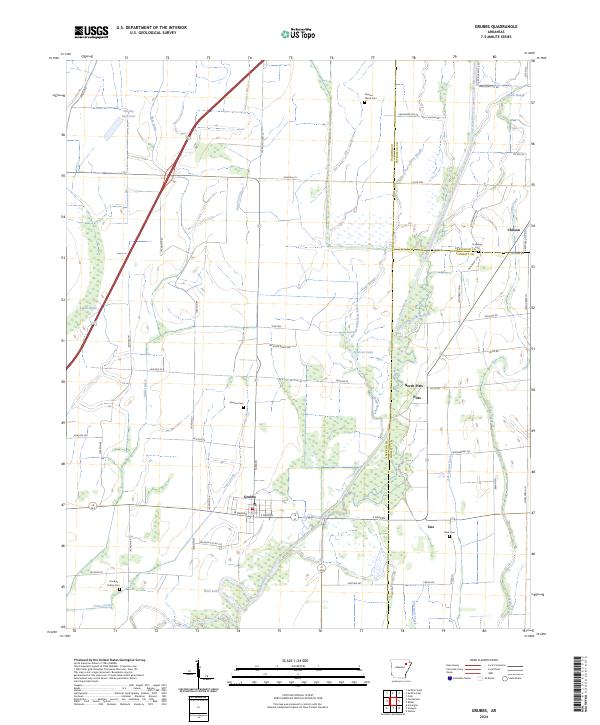
2024 Map of Grubbs
USGS Topo · Published 2024About this map
The Cache River bottomlands dominate this landscape in eastern Arkansas, where the river's winding path and the Old Channel Cache River create a complex network of wetlands and sloughs. Settlement is concentrated along the higher ground, anchored by the town of Grubbs and smaller communities like North Pitts, Pitts, and Uno. The map reveals a highly managed hydrological system designed for the region's agricultural needs, featuring numerous engineered waterways such as Harley-Anderson Ditch, Gum Pond Ditch, and Tiger Ditch. For genealogists and local historians, the sheet is exceptionally well-marked with family-named landmarks and burial sites, including the Hankins-Sullins Cem, Denton Island Cem, and Holloway Cem. This modern survey provides a precise look at the rural road network, where local routes like Jackson Rd 226 and Co Rd 272 connect isolated farmsteads and small water bodies like Johnson Lake and Tupelo Brake.
Find a feature on this map
67 named features on this map. Tap any name to fly to it.
Don’t see what you’re looking for? This feature index may not catch every label — zoom into the map to look around manually.
Map Details
Editions of this 2024 Grubbs Map
This is the sole edition of this map. No revisions or reprints were ever made.
Other maps of this area

1935 · Sedgwick
USGS Topo · 1:62,500

1935 · Alicia
USGS Topo · 1:62,500

1935 · Tuckerman
USGS Topo · 1:62,500

1939 · Weiner
USGS Topo · 1:62,500

1953 · Memphis
USGS Topo · 1:250,000

1956 · Memphis
USGS Topo · 1:250,000

1959 · Weiner
USGS Topo · 1:62,500

1959 · Sedgwick
USGS Topo · 1:62,500

1960 · Weiner
USGS Topo · 1:62,500
1960 · Sedgwick
USGS Topo · 1:62,500