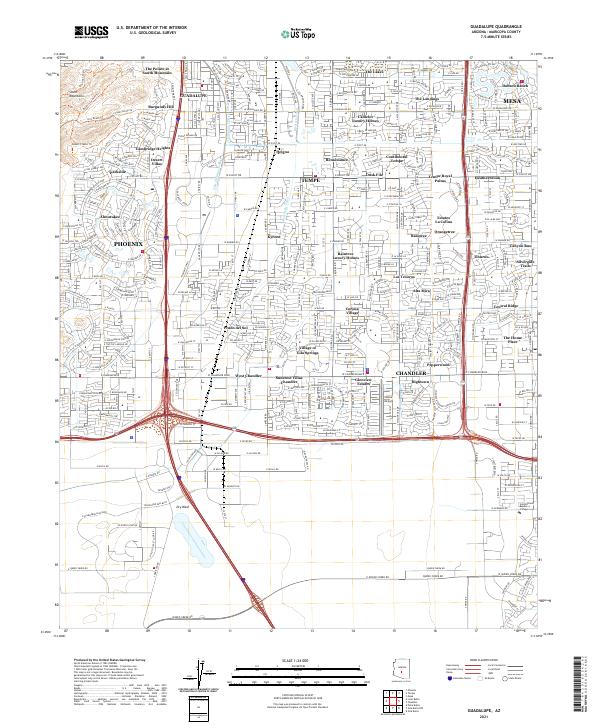
2021 Map of Guadalupe
USGS Topo · Published 2021About this map
Guadalupe stands as a focal point in this 21st-century landscape, surrounded by the suburban expansion of Phoenix, Tempe, and West Chandler. The map reveals a complex water management system essential to the desert environment, featuring the Highline Canal, Western Canal, and the Kyrene Br Canal. These engineered waterways cut through modern residential developments like The Lakes and Corona Village, illustrating how former agricultural infrastructure has been integrated into a dense urban grid.
Find a feature on this map
59 named features on this map. Tap any name to fly to it.
Don’t see what you’re looking for? This feature index may not catch every label — zoom into the map to look around manually.
Map Details
Editions of this 2021 Guadalupe Map
This is the sole edition of this map. No revisions or reprints were ever made.
Historical Maps of Phoenix Through Time
3 maps found