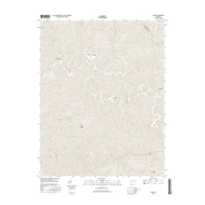
2016 Map of Guage
USGS Topo · Published 2016About this map
Rousseau and Guage sit within the high ridges of the Cumberland Plateau, where human settlement follows the narrow corridors of creek forks and hollows. This 2016 survey by the U.S. Geological Survey shows a landscape defined by traditional Appalachian geography, where family-named routes like Press Howard Fork and Jones Branch provide access through the complex topography. The boundary between Magoffin and Breathitt counties cuts across the northeastern corner, highlighting the isolation of these small communities. Settlements such as Lunah and Lambric are connected by winding roads like Quicksand Creek Rd, which traces the valley floors. For genealogists and local historians, the map identifies specific locales like Wells Fork and secluded terrain features including Eaf Hollow and Maple Hollow, offering a modern record of the region's enduring settlement patterns.
Find a feature on this map
18 named features on this map. Tap any name to fly to it.
Don’t see what you’re looking for? This feature index may not catch every label — zoom into the map to look around manually.
Map Details
Editions of this 2016 Guage Map
This is the sole edition of this map. No revisions or reprints were ever made.
Other maps of this area

1889 · Salyersville
USGS Topo · 1:125,000

1891 · Hazard
USGS Topo · 1:125,000

1891 · Salyersville
USGS Topo · 1:125,000

1899 · Salyersville
USGS Topo · 1:125,000

1913 · Buckhorn
USGS Topo · 1:62,500

1914 · Troublesome
USGS Topo · 1:62,500

1951 · Tiptop
USGS Topo · 1:24,000

1951 · Guage
USGS Topo · 1:24,000

1951 · Seitz
USGS Topo · 1:24,000

1951 · Quicksand
USGS Topo · 1:24,000