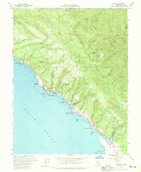
1960 Map of Gualala
USGS Topo · Published 1970About this map
The Gualala settlement and its coastal surroundings are documented during a period of transition between maritime activity and inland industry. Positioned at the mouth of the Gualala River, the town shows evidence of its logging economy with a prominent Lumber Mill situated near the county line between Mendocino Co and Sonoma Co. The coastline is dotted with historical points of interest such as Collins Landing, Bourns Landing, and Anchor Bay, illustrating the reliance on small maritime outposts for transport before modern highway systems dominated the region.
Find a feature on this map
54 named features on this map. Tap any name to fly to it.
Don’t see what you’re looking for? This feature index may not catch every label — zoom into the map to look around manually.
Map Details
Editions of this 1960 Gualala Map
3 editions found
Other maps of this area

1921 · Plantation
USGS Topo · 1:62,500

1943 · Point Arena
USGS Topo · 1:62,500

1943 · Stewarts Point
USGS Topo · 1:24,000

1943 · Ornbaun
USGS Topo · 1:62,500

1944 · Stewarts Point
USGS Topo · 1:31,680

1944 · Ornbaun
USGS Topo · 1:62,500

1947 · Santa Rosa
USGS Topo · 1:250,000

1949 · Santa Rosa
USGS Topo · 1:250,000

1958 · Santa Rosa
USGS Topo · 1:250,000

1960 · Saunders Reef
USGS Topo · 1:24,000