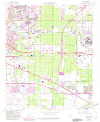
1966 Map of Guasti
USGS Topo · Published 1982About this map
Rancho Cucamonga and its surrounding vineyards undergo a period of rapid industrial and infrastructure transition in this mid-century survey. The landscape is anchored by the Cucamonga Winery, signaling the region's agricultural roots, yet the emergence of the Ontario Motor Speedway and the massive Steel Plant to the east reflects the shifting economic base toward heavy industry and entertainment. Transportation corridors dominate the geography, with the San Bernardino Freeway and Mission Blvd cutting across a grid of citrus groves and expanding residential tracts.
Find a feature on this map
46 named features on this map. Tap any name to fly to it.
Don’t see what you’re looking for? This feature index may not catch every label — zoom into the map to look around manually.
Map Details
Editions of this 1966 Guasti Map
4 editions found
Other maps of this area

1896 · San Bernardino
USGS Topo · 1:62,500

1897 · Cucamonga
USGS Topo · 1:62,500

1898 · San Bernardino
USGS Topo · 1:62,500

1900 · Cucamonga
USGS Topo · 1:62,500

1901 · Southern California Sheet No. 1
USGS Topo · 1:250,000

1901 · San Bernardino
USGS Topo · 1:62,500

1901 · Elsinore
USGS Topo · 1:125,000

1901 · Riverside
USGS Topo · 1:62,500

1902 · Corona
USGS Topo · 1:125,000

1903 · Cucamonga
USGS Topo · 1:62,500