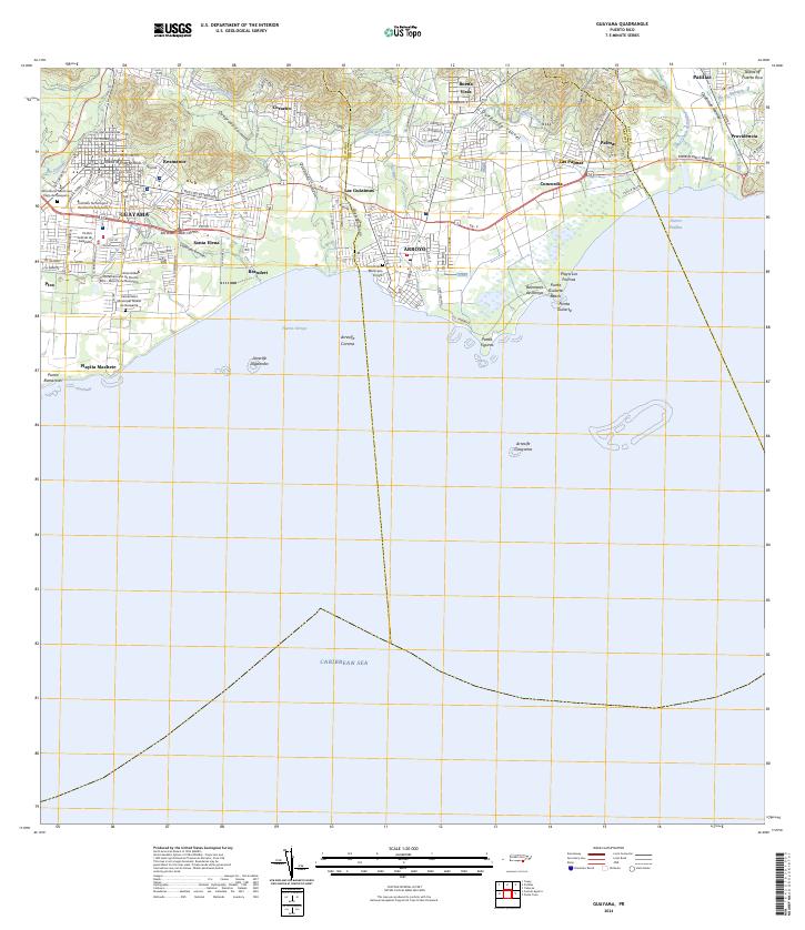
2024 Map of Guayama
USGS Topo · Published 2024About this map
The south-central coast of Puerto Rico meets the Caribbean Sea in this detailed study of Guayama and its surrounding communities. The landscape is defined by the transition from the upland reaches of Corazón and Buena Vista down to the coastal plains of Arroyo and Patillas. An intricate network of water management is visible, featuring the Canal de Guamaní Este and the Canal de Patillas, which historically supported the region's agricultural infrastructure.
Find a feature on this map
56 named features on this map. Tap any name to fly to it.
Don’t see what you’re looking for? This feature index may not catch every label — zoom into the map to look around manually.
Map Details
Editions of this 2024 Guayama Map
This is the sole edition of this map. No revisions or reprints were ever made.
Other maps of this area

1945 · Punta Tuna
USGS Topo · 1:30,000

1945 · Central Aguirre
USGS Topo · 1:30,000

1946 · Patillas
USGS Topo · 1:30,000

1946 · Cayey
USGS Topo · 1:30,000

1946 · Yabucoa
USGS Topo · 1:30,000

1946 · Guayama
USGS Topo · 1:30,000

1947 · Yabucoa SO
USGS Topo · 1:10,000

1947 · Patillas SO
USGS Topo · 1:10,000
1947 · Guayama NE
USGS Topo · 1:10,000
1947 · Punta Tuna NO
USGS Topo · 1:10,000