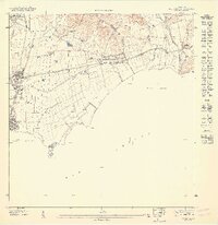
1947 Map of Guayama NE
USGS Topo · Published 1947About this map
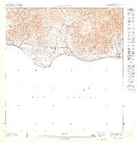
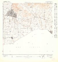
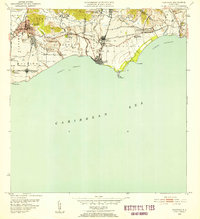
Central Lafayette serves as the industrial anchor for this coastal stretch of southeast Puerto Rico, where sugar production and transport define the landscape. The sugar mill is supported by a specialized rail network, including the Linea Asociacion Azucarera, which connects the processing center to agricultural outposts like Colonia Concordia and Colonia Providencia. To the west, the settlement of Arroyo is clearly delineated with its street grid and proximity to the Río Nigua, while a dedicated U. S. Mil. Res. occupies the strategic coastal point at Pta Figuras.
Find a feature on this map
26 named features on this map. Tap any name to fly to it.
Don’t see what you’re looking for? This feature index may not catch every label — zoom into the map to look around manually.
Map Details
Editions of this 1947 Guayama NE Map
This is the sole edition of this map. No revisions or reprints were ever made.
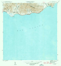
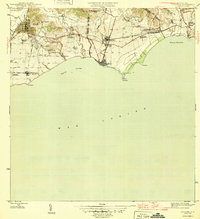
Other maps of this area
1945 · Punta Tuna
USGS Topo · 1:30,000

1946 · Patillas
USGS Topo · 1:30,000

1946 · Yabucoa
USGS Topo · 1:30,000
1946 · Guayama
USGS Topo · 1:30,000
1947 · Yabucoa SO
USGS Topo · 1:10,000

1947 · Patillas SO
USGS Topo · 1:10,000
1947 · Punta Tuna NO
USGS Topo · 1:10,000
1947 · Guayama NO
USGS Topo · 1:10,000
1947 · Patillas SE
USGS Topo · 1:10,000
1952 · Guayama
USGS Topo · 1:30,000
Featured Places
- Arroyo, Arroyo
- Sector Los Sánchez, Patillas
- Bariada Buenos Aires 2, Arroyo
- Barriada Buenos Aires 1, Arroyo
- Reparto Campo Mar, Arroyo