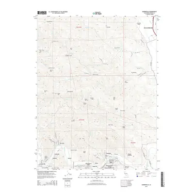
2015 Map of Guerneville
USGS Topo · Published 2015About this map
The Russian River winds through the heart of this Sonoma County landscape, anchoring a string of riverside communities from Guerneville and Rio Nido in the west to Hacienda and Rio Dell in the east. This 2015 survey illustrates a region defined by its narrow valleys and prominent ridges, including the ascent to Mt Jackson and the lookout from Queens Peak. The proximity of the river to the rugged slopes of Big Ridge and Gilder Ridge created a unique development pattern where small settlements like Korbel and Hilton are clustered along the water's edge and the canyon floor.
Find a feature on this map
93 named features on this map. Tap any name to fly to it.
Don’t see what you’re looking for? This feature index may not catch every label — zoom into the map to look around manually.
Map Details
Editions of this 2015 Guerneville Map
This is the sole edition of this map. No revisions or reprints were ever made.
Other maps of this area

1920 · Healdsburg
USGS Topo · 1:62,500

1921 · Skaggs
USGS Topo · 1:62,500

1933 · Healdsburg
USGS Topo · 1:48,000

1935 · Sebastopol
USGS Topo · 1:48,000

1940 · Healdsburg
USGS Topo · 1:62,500

1942 · Sebastopol
USGS Topo · 1:62,500

1943 · Cazadero
USGS Topo · 1:24,000

1943 · Duncans Mills
USGS Topo · 1:24,000

1943 · Skaggs Springs
USGS Topo · 1:24,000

1944 · Skaggs Springs
USGS Topo · 1:31,680