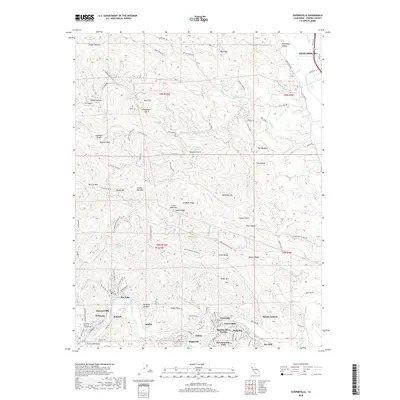
2018 Map of Guerneville
USGS Topo · Published 2018About this map
Russian River winding through the redwoods and ridges of Sonoma County defines the character of this late 2010s survey. The map details a dense corridor of riverside communities from Guerneville and Rio Nido eastward through Korbel, Hilton, and Summerhome Park. These settlements, concentrated along River Rd, showcase the area's long-standing transition from industrial logging roots to a renowned recreational and residential landscape. High above the valley floor, the rugged terrain of the Coast Range is marked by prominent peaks like Mt Jackson and deeply incised drainages such as Pickle Canyon and Coldwater Gulch. To the northeast, the outskirts of Healdsburg appear near the confluence of Dry Creek and W Slough, where the landscape shifts from dense forest to the vineyard-flecked valley floor. Local landmarks like the Guerneville Bridge and McPeak Cem provide specific points of interest for genealogists and local historians tracing the development of these river towns.
Find a feature on this map
113 named features on this map. Tap any name to fly to it.
Don’t see what you’re looking for? This feature index may not catch every label — zoom into the map to look around manually.
Map Details
Editions of this 2018 Guerneville Map
This is the sole edition of this map. No revisions or reprints were ever made.
Other maps of this area

1920 · Healdsburg
USGS Topo · 1:62,500

1921 · Skaggs
USGS Topo · 1:62,500

1933 · Healdsburg
USGS Topo · 1:48,000

1935 · Sebastopol
USGS Topo · 1:48,000

1940 · Healdsburg
USGS Topo · 1:62,500

1942 · Sebastopol
USGS Topo · 1:62,500

1943 · Cazadero
USGS Topo · 1:24,000

1943 · Duncans Mills
USGS Topo · 1:24,000

1943 · Skaggs Springs
USGS Topo · 1:24,000

1944 · Skaggs Springs
USGS Topo · 1:31,680