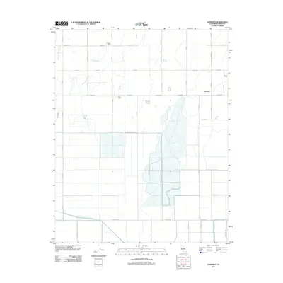
2012 Map of Guernsey
USGS Topo · Published 2012About this map
Guernsey sits at the center of this agricultural landscape in Kings County, defined by a rigid grid of numbered avenues and an intricate network of irrigation infrastructure. This 2012 survey documents the water management systems vital to the region, including the West Branch Last Chance Ditch and the Tulare Lake Canal in the south. These engineered waterways contrast with the natural meandering paths of Jacobs Slough and Sand Slough, which weave across the north and central sectors. The map highlights specific rural landmarks such as the Paddock School, King's Ranch, and Valadao Dairy, reflecting a community deeply tied to ranching and dairy production. Large rectangular evaporation ponds or water storage basins dominate the central terrain, illustrating the intensive land use required for California's Central Valley farming operations.
Find a feature on this map
27 named features on this map. Tap any name to fly to it.
Don’t see what you’re looking for? This feature index may not catch every label — zoom into the map to look around manually.
Map Details
Editions of this 2012 Guernsey Map
This is the sole edition of this map. No revisions or reprints were ever made.
Other maps of this area

1926 · Hanford
USGS Topo · 1:31,680

1927 · Remnoy
USGS Topo · 1:31,680

1927 · Lemoore
USGS Topo · 1:31,680

1928 · Waukena
USGS Topo · 1:31,680

1928 · Corcoran
USGS Topo · 1:31,680

1929 · Guernsey
USGS Topo · 1:31,680

1929 · Stratford
USGS Topo · 1:31,680

1932 · El Rico Ranch
USGS Topo · 1:31,680

1933 · Chatom Ranch
USGS Topo · 1:31,680
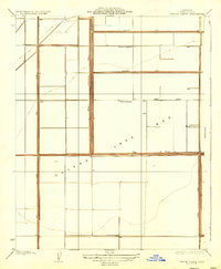
1935 · Chatom Ranch
USGS Topo · 1:31,680