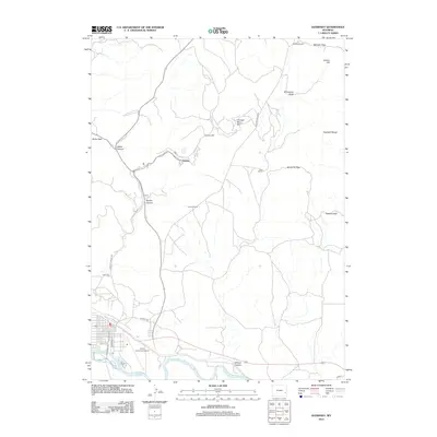
2012 Map of Guernsey
USGS Topo · Published 2012About this map
Sunrise and the nearby Chicago Mine Hill dominate the northern landscape of this region, reflecting the area's deep ties to the iron mining industry. The terrain is characterized by a series of significant crossings and canyons, including Whalen Canyon and various mountain gaps like McGinnis Pass, Seward Pass, and McCann Pass. This topography dictates the movement through the Haystack Range, where legacy homesteads such as Frederick Ranch, Ross Ranch, and Graves Ranch are established among the draws and hills.
Find a feature on this map
29 named features on this map. Tap any name to fly to it.
Don’t see what you’re looking for? This feature index may not catch every label — zoom into the map to look around manually.
Map Details
Editions of this 2012 Guernsey Map
This is the sole edition of this map. No revisions or reprints were ever made.
Other maps of this area

1896 · Hartville
USGS Topo · 1:125,000

1901 · Hartville
USGS Topo · 1:125,000

1950 · Guernsey
USGS Topo · 1:24,000

1950 · Casebier Hill
USGS Topo · 1:24,000

1950 · Fort Laramie
USGS Topo · 1:24,000

1950 · Register Cliff
USGS Topo · 1:24,000

1950 · Haushar Ranch
USGS Topo · 1:24,000

1950 · Hell Gap
USGS Topo · 1:24,000

1950 · Guernsey Reservoir
USGS Topo · 1:24,000

1951 · Haushar Ranch
USGS Topo · 1:24,000