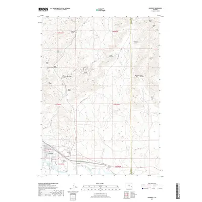
2017 Map of Guernsey
USGS Topo · Published 2017About this map
Guernsey sits at the southern edge of this modern survey, where the North Platte River flows near the Guernsey Fish Pond and the Camp Guernsey Airport. Moving north into the hills, the industrial and mining legacy of the region is evident in the layout of Hartville and the settlement of Sunrise. This area is defined by a complex network of narrow passages and draws, including Whalen Canyon, Webb Canyon, and Sparks Canyon, which cut through the uplifted terrain. The presence of Chicago Mine Hill and Sunrise Hill points to the long-standing iron ore operations that historically fueled these communities. To the east, the Haystack Range marks the boundary between Platte Co and Goshen Co, while local history is preserved at the Prairie Rest Cem and the evocatively named Boot Hill near Hartville.
Find a feature on this map
54 named features on this map. Tap any name to fly to it.
Don’t see what you’re looking for? This feature index may not catch every label — zoom into the map to look around manually.
Map Details
Editions of this 2017 Guernsey Map
This is the sole edition of this map. No revisions or reprints were ever made.
Other maps of this area

1896 · Hartville
USGS Topo · 1:125,000

1901 · Hartville
USGS Topo · 1:125,000

1950 · Guernsey
USGS Topo · 1:24,000

1950 · Casebier Hill
USGS Topo · 1:24,000

1950 · Fort Laramie
USGS Topo · 1:24,000

1950 · Register Cliff
USGS Topo · 1:24,000

1950 · Haushar Ranch
USGS Topo · 1:24,000

1950 · Hell Gap
USGS Topo · 1:24,000

1950 · Guernsey Reservoir
USGS Topo · 1:24,000

1951 · Haushar Ranch
USGS Topo · 1:24,000