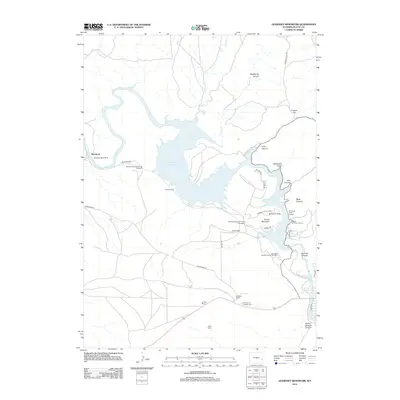
2012 Map of Guernsey Reservoir
USGS Topo · Published 2012About this map
The N Platte River carves through a landscape defined by water management and heavy transit in this survey of the area surrounding Guernsey State Park. The impounded waters of the Guernsey Reservoir are framed by a complex network of canyons and gulches, including Deadhorse Canyon and Black Canyon. This rugged corridor is a critical passage for the railroad, evidenced by the series of Burlington Northern tunnels, such as Burlington Northern Tunnel Number 2, which pierce the terrain to maintain the grade along the riverbank.
Find a feature on this map
37 named features on this map. Tap any name to fly to it.
Don’t see what you’re looking for? This feature index may not catch every label — zoom into the map to look around manually.
Map Details
Editions of this 2012 Guernsey Reservoir Map
This is the sole edition of this map. No revisions or reprints were ever made.
Other maps of this area

1896 · Hartville
USGS Topo · 1:125,000

1901 · Hartville
USGS Topo · 1:125,000

1950 · Guernsey
USGS Topo · 1:24,000

1950 · Herman Ranch
USGS Topo · 1:24,000

1950 · Register Cliff
USGS Topo · 1:24,000

1950 · Haushar Ranch
USGS Topo · 1:24,000

1950 · Hell Gap
USGS Topo · 1:24,000

1950 · Guernsey Reservoir
USGS Topo · 1:24,000

1951 · Haushar Ranch
USGS Topo · 1:24,000

1951 · Guernsey Reservoir
USGS Topo · 1:24,000