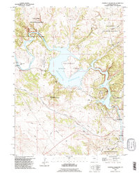
1990 Map of Guernsey Reservoir
USGS Topo · Published 1995About this map
The North Platte River winds through this portion of Wyoming, shaped by the waters of the Guernsey Reservoir and the surrounding Guernsey State Park. This 1990 revision, based on earlier mid-century surveys, illustrates a landscape where early western migration routes intersect with modern military and recreational land use. The historical significance of the area is anchored by the Emigrant Trail and multiple Oregon Trail Markers that trace the path of nineteenth-century travelers through the hills near Emigrant Hill.
Find a feature on this map
38 named features on this map. Tap any name to fly to it.
Don’t see what you’re looking for? This feature index may not catch every label — zoom into the map to look around manually.
Map Details
Editions of this 1990 Guernsey Reservoir Map
This is the sole edition of this map. No revisions or reprints were ever made.
Other maps of this area

1896 · Hartville
USGS Topo · 1:125,000

1901 · Hartville
USGS Topo · 1:125,000

1950 · Guernsey
USGS Topo · 1:24,000

1950 · Herman Ranch
USGS Topo · 1:24,000

1950 · Register Cliff
USGS Topo · 1:24,000

1950 · Haushar Ranch
USGS Topo · 1:24,000

1950 · Hell Gap
USGS Topo · 1:24,000

1950 · Guernsey Reservoir
USGS Topo · 1:24,000

1951 · Haushar Ranch
USGS Topo · 1:24,000

1951 · Guernsey Reservoir
USGS Topo · 1:24,000