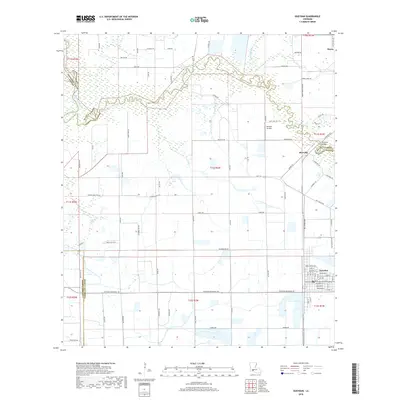
2018 Map of Gueydan
USGS Topo · Published 2018About this map
The town of Gueydan serves as the focal point of this Vermilion Parish landscape, where the agricultural grid meets the winding waters of the Mermentau River and Bayou Queue De Tortue. This 2018 survey reveals a terrain defined by complex water management and rural aviation, featuring the Venissat Airstrip and numerous waterways such as Lazy Point Canal and Moon Island Canal. The settlement of Riceville sits just north of the bayou, connected by the Riceville Bridge at a point where Acadia and Vermilion parishes meet.
Find a feature on this map
96 named features on this map. Tap any name to fly to it.
Don’t see what you’re looking for? This feature index may not catch every label — zoom into the map to look around manually.
Map Details
Editions of this 2018 Gueydan Map
This is the sole edition of this map. No revisions or reprints were ever made.
Other maps of this area

1946 · Morse
USGS Topo · 1:31,680

1946 · Lake Arthur
USGS Topo · 1:31,680

1946 · Schooner Bayou NW
USGS Topo · 1:31,680

1946 · Mermentau
USGS Topo · 1:31,680

1946 · Jennings
USGS Topo · 1:31,680

1949 · Gueydan
USGS Topo · 1:31,680

1949 · Estherwood
USGS Topo · 1:31,680

1952 · Lake Charles
USGS Topo · 1:250,000

1954 · Grand Lake East NW
USGS Topo · 1:31,680
1954 · Schooner Bayou NW
USGS Topo · 1:31,680