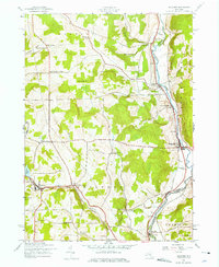
1943 Map of Guilford
USGS Topo · Published 1975About this map
The Unadilla River forms a natural boundary between Chenango and Otsego counties, serving as the industrial and transport corridor for this Central New York landscape. In the early 1940s, the New York Ontario and Western railroad followed the river's winding path through Rockwells Mills and Mount Upton, while also cutting southwest toward the village of Guilford near Guilford Lake. The presence of small rural centers like White Store and Ives Settlement highlights a traditional agricultural pattern of family-named corners and localized school districts, such as School No 9.
Find a feature on this map
38 named features on this map. Tap any name to fly to it.
Don’t see what you’re looking for? This feature index may not catch every label — zoom into the map to look around manually.
Map Details
Editions of this 1943 Guilford Map
3 editions found
Other maps of this area

1902 · Coventry
USGS Topo · 1:62,500

1903 · Norwich
USGS Topo · 1:62,500

1904 · Oxford
USGS Topo · 1:62,500

1910 · New Berlin
USGS Topo · 1:62,500

1912 · New Berlin
USGS Topo · 1:62,500

1915 · Unadilla
USGS Topo · 1:62,500

1918 · Unadilla
USGS Topo · 1:62,500

1943 · Sidney
USGS Topo · 1:24,000

1943 · New Berlin South
USGS Topo · 1:24,000

1943 · Gilbertsville
USGS Topo · 1:24,000