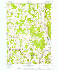
1943 Map of Guilford
USGS Topo · Published 1975About this map
The Unadilla River valley serves as a focal point for settlement and industry in this 1940s landscape, marking the boundary between Chenango and Otsego counties. The presence of Rockwells Mills along the river and the New York Ontario and Western railroad corridor illustrates the transition from traditional milling to modern rail transport. Further inland, the map captures a rural social geography defined by local clusters like Ives Settlement, Guilford Center, and Webb Corners. Numerous numbered schoolhouses, including School No 9 and School No 10, remain in place, documenting the era's decentralized education system. From the recreational waters of Guilford Lake to the terrain at Shumway Hill, this survey records a mid-century interior New York landscape of family-named corners and small-scale water features like White Store Falls.
Find a feature on this map
37 named features on this map. Tap any name to fly to it.
Don’t see what you’re looking for? This feature index may not catch every label — zoom into the map to look around manually.
Map Details
Editions of this 1943 Guilford Map
3 editions found
Other maps of this area

1902 · Coventry
USGS Topo · 1:62,500

1903 · Norwich
USGS Topo · 1:62,500

1904 · Oxford
USGS Topo · 1:62,500

1910 · New Berlin
USGS Topo · 1:62,500

1912 · New Berlin
USGS Topo · 1:62,500

1915 · Unadilla
USGS Topo · 1:62,500

1918 · Unadilla
USGS Topo · 1:62,500

1943 · Sidney
USGS Topo · 1:24,000

1943 · New Berlin South
USGS Topo · 1:24,000

1943 · Gilbertsville
USGS Topo · 1:24,000