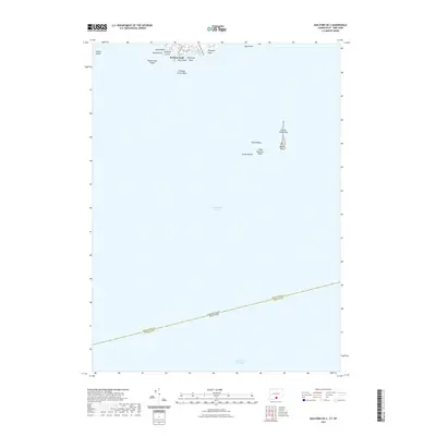
2021 Map of Guilford OE S
USGS Topo · Published 2021About this map
Falkner Island stands as a lonely outpost in the center of this maritime survey, surrounded by the Falkner Island Reef and various navigational hazards like North Rocks and Three Quarters Rock. The map illustrates the state boundary between Connecticut and New York, which runs through the open waters of Long Island Sound, separating New Haven and Suffolk Counties.
Find a feature on this map
24 named features on this map. Tap any name to fly to it.
Don’t see what you’re looking for? This feature index may not catch every label — zoom into the map to look around manually.
Map Details
Editions of this 2021 Guilford OE S Map
This is the sole edition of this map. No revisions or reprints were ever made.
Other maps of this area

1892 · New Haven
USGS Topo · 1:62,500

1893 · Guilford
USGS Topo · 1:62,500

1921 · New Haven
USGS Topo · 1:62,500

1947 · Mattituck Hills
USGS Topo · 1:24,000

1947 · Hartford
USGS Topo · 1:250,000

1948 · Hartford
USGS Topo · 1:250,000

1951 · Clinton
USGS Topo · 1:31,680

1954 · Guilford
USGS Topo · 1:31,680
1954 · Branford
USGS Topo · 1:31,680
1956 · Mattituck Hills
USGS Topo · 1:24,000