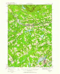
1933 Map of Guilford
USGS Topo · Published 1961About this map
The Piscataquis River corridor serves as the industrial and transit spine of this central Maine landscape, where the Bangor and Aroostook railroad connects the milling and manufacturing centers of Guilford and Abbot Village. This 1933 survey details a transition from the river-powered industry of Spooners Mill to the emerging seasonal recreation economy at Wassookeag Camp on the shores of Lake Wassookeag.
Find a feature on this map
88 named features on this map. Tap any name to fly to it.
Don’t see what you’re looking for? This feature index may not catch every label — zoom into the map to look around manually.
Map Details
Editions of this 1933 Guilford Map
5 editions found
Other maps of this area

1913 · Skowhegan
USGS Topo · 1:62,500

1930 · Pittsfield
USGS Topo · 1:48,000

1931 · Stetson
USGS Topo · 1:48,000

1932 · Dover-Foxcroft
USGS Topo · 1:48,000

1932 · Pittsfield
USGS Topo · 1:62,500

1933 · Pittsfield
USGS Topo · 1:62,500

1933 · Guilford
USGS Topo · 1:62,500

1935 · Dover-Foxcroft
USGS Topo · 1:62,500

1935 · Stetson
USGS Topo · 1:62,500

1937 · Guilford
USGS Topo · 1:62,500