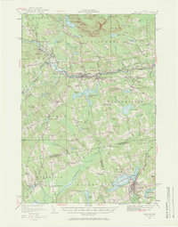
1933 Map of Guilford
USGS Topo · Published 1971About this map
The Piscataquis River corridor serves as the primary artery through this Central Maine landscape, connecting industrial and rail hubs during the early 1930s. The Bangor and Piscataquis River and Moosehead Lake RR meets the Maine Central RR at Monson Junction, reflecting a period when rail transport was vital to the local economy. In Guilford and Sangerville, the concentration of structures near the riverbanks highlights the historical importance of water power and bridge crossings like Lows Bridge.
Find a feature on this map
128 named features on this map. Tap any name to fly to it.
Don’t see what you’re looking for? This feature index may not catch every label — zoom into the map to look around manually.
Map Details
Editions of this 1933 Guilford Map
5 editions found
Other maps of this area

1913 · Skowhegan
USGS Topo · 1:62,500

1930 · Pittsfield
USGS Topo · 1:48,000

1931 · Stetson
USGS Topo · 1:48,000

1932 · Dover-Foxcroft
USGS Topo · 1:48,000

1932 · Pittsfield
USGS Topo · 1:62,500

1933 · Pittsfield
USGS Topo · 1:62,500

1933 · Guilford
USGS Topo · 1:62,500

1935 · Dover-Foxcroft
USGS Topo · 1:62,500

1935 · Stetson
USGS Topo · 1:62,500

1937 · Guilford
USGS Topo · 1:62,500