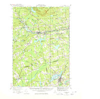
1933 Map of Guilford
USGS Topo · Published 1980About this map
Guilford and its neighbors in the 1930s defined a landscape where the Piscataquis River and the Bangor and Aroostook RR shaped local commerce. Industrial activity is anchored by Spooners Mill near Dexter, while the intersection of Route 15 and Route 16 at Abbot Village marks a primary transit hub for the region. The map reveals a dense network of rural infrastructure, from the Abbot Village Sta to numerous country schoolhouses like the Cambridge Flats Sch and Howard Corner Sch.
Find a feature on this map
125 named features on this map. Tap any name to fly to it.
Don’t see what you’re looking for? This feature index may not catch every label — zoom into the map to look around manually.
Map Details
Editions of this 1933 Guilford Map
5 editions found
Other maps of this area

1913 · Skowhegan
USGS Topo · 1:62,500

1930 · Pittsfield
USGS Topo · 1:48,000

1931 · Stetson
USGS Topo · 1:48,000

1932 · Dover-Foxcroft
USGS Topo · 1:48,000

1932 · Pittsfield
USGS Topo · 1:62,500

1933 · Pittsfield
USGS Topo · 1:62,500

1933 · Guilford
USGS Topo · 1:62,500

1935 · Dover-Foxcroft
USGS Topo · 1:62,500

1935 · Stetson
USGS Topo · 1:62,500

1937 · Guilford
USGS Topo · 1:62,500