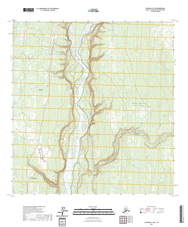
2023 Map of Gulkana A-3 NW
USGS Topo · Published 2023About this map
The confluence of the Gulkana River and the Copper River forms a braided landscape of active waterways and wetlands in this high-latitude region. The Richardson Highway serves as the primary artery through the area, connecting the established communities of Gulkana and Glennallen. Near these settlements, the Gulkana Airport stands as a critical transportation hub for the interior. East of the river system, the terrain transitions into the protected wilderness of the Wrangell-Saint Elias National Preserve, where the map illustrates the complex drainage patterns of seasonal watercourses like Dry Creek. This survey captures the intersection of critical infrastructure and a volatile river environment, where gravel bars and shifting channels dictate the layout of roads and aviation facilities.
Find a feature on this map
14 named features on this map. Tap any name to fly to it.
Don’t see what you’re looking for? This feature index may not catch every label — zoom into the map to look around manually.
Map Details
Editions of this 2023 Gulkana A-3 NW Map
This is the sole edition of this map. No revisions or reprints were ever made.
Other maps of this area

1949 · Gulkana A-3
USGS Topo · 1:63,360

1950 · Gulkana B-3
USGS Topo · 1:63,360

1951 · Gulkana
USGS Topo · 1:250,000

1951 · Gulkana A-4
USGS Topo · 1:63,360

1951 · Gulkana B-4
USGS Topo · 1:63,360

1952 · Gulkana A-3
USGS Topo · 1:63,360

1952 · Gulkana B-3
USGS Topo · 1:63,360

1952 · Gulkana A-4
USGS Topo · 1:63,360
1952 · Gulkana B-4
USGS Topo · 1:63,360

1959 · Gulkana
USGS Topo · 1:250,000