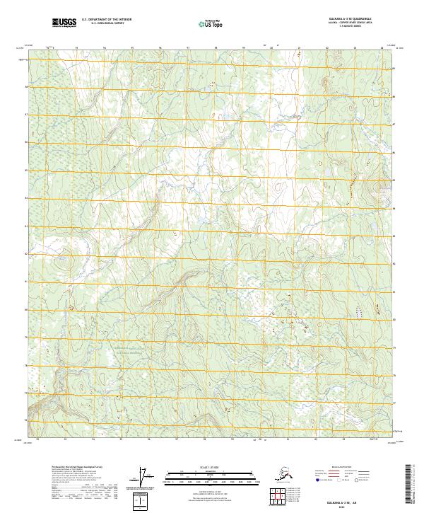
2023 Map of Gulkana A-3 SE
USGS Topo · Published 2023About this map
The Wrangell-Saint Elias National Preserve dominates the southern half of this landscape, protecting a vast stretch of the Copper River Census Area. The topography is defined by the hydrologic movement of the Klawasi River, which meanders through the northern sections of the quadrangle. Geothermal activity is a subtle but distinctive characteristic of this region, evidenced by the presence of Mineral Spring and Warm Spring. These natural features indicate a complex subsurface environment within the larger Copper River basin. The map illustrates the structured township and range system, specifically marking t4n r1e, t4n r2e, t3n r1e, and t3n r2e, which provide the cadastral framework for this portion of the Alaskan interior.
Find a feature on this map
8 named features on this map. Tap any name to fly to it.
Don’t see what you’re looking for? This feature index may not catch every label — zoom into the map to look around manually.
Map Details
Editions of this 2023 Gulkana A-3 SE Map
This is the sole edition of this map. No revisions or reprints were ever made.
Other maps of this area

1949 · Gulkana A-3
USGS Topo · 1:63,360

1949 · Valdez D-4
USGS Topo · 1:63,360

1951 · Gulkana
USGS Topo · 1:250,000

1952 · Gulkana A-3
USGS Topo · 1:63,360

1952 · Valdez
USGS Topo · 1:250,000

1952 · Valdez D-4
USGS Topo · 1:63,360

1958 · Valdez D-3
USGS Topo · 1:63,360
1959 · Gulkana A-2
USGS Topo · 1:63,360

1959 · Gulkana
USGS Topo · 1:250,000

1960 · Valdez
USGS Topo · 1:250,000