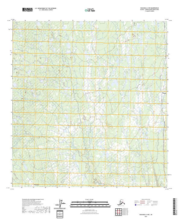
2023 Map of Gulkana A-4 NE
USGS Topo · Published 2023About this map
Moose Creek winds through the interior landscape of the Copper River Census Area, highlighting a region defined by modern infrastructure and sparse settlements. The eastern edge of the quadrangle is dominated by the Alaska Pipeline, which runs north-to-south through the terrain. A specific infrastructure landmark is noted at the Alaska Pipeline Glenn Highway Crossing MP 684.5 (North), indicating the intersection of vital transport and energy corridors in this portion of the Alaskan wilderness. Small clusters of development at Gulkana and the northern edge of Glennallen anchor the human presence here, providing a clear picture of how these roadside communities are positioned relative to the local hydrology and the industrial footprint of the pipeline during the early 2020s.
Find a feature on this map
9 named features on this map. Tap any name to fly to it.
Don’t see what you’re looking for? This feature index may not catch every label — zoom into the map to look around manually.
Map Details
Editions of this 2023 Gulkana A-4 NE Map
This is the sole edition of this map. No revisions or reprints were ever made.
Other maps of this area

1949 · Gulkana A-3
USGS Topo · 1:63,360

1950 · Gulkana B-3
USGS Topo · 1:63,360

1951 · Gulkana
USGS Topo · 1:250,000

1951 · Gulkana A-4
USGS Topo · 1:63,360

1951 · Gulkana B-4
USGS Topo · 1:63,360

1952 · Gulkana A-3
USGS Topo · 1:63,360

1952 · Gulkana B-3
USGS Topo · 1:63,360

1952 · Gulkana A-4
USGS Topo · 1:63,360
1952 · Gulkana B-4
USGS Topo · 1:63,360

1959 · Gulkana
USGS Topo · 1:250,000