
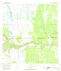
1951 Map of Gulkana A-4
USGS Topo · Published 1963About this map
The Tazlina River meanders through this portion of south-central Alaska, joined by major tributaries like Tazlina Creek and Moose Creek. The landscape is defined by the early development of the Glenn Highway corridor, which served as a vital lifeline for commerce and tourism in the mid-20th century. This survey, annotated in the early 1950s, reveals a cluster of roadside hospitality sites including the Glennallen Lodge, Ranch House Lodge, and I Bar F Lodge, marking the era's reliance on highway-based infrastructure. The nascent settlement of Glennallen is visible at the eastern edge of the map, established as a strategic junction for the Copper River region. Away from the road, a dense network of water bodies such as Twin Lakes, Mud Lake, and Plumb Bob Lake reflects a wilder interior accessible by trails and small outposts like the Campground near Tolsona Creek.
Find a feature on this map
18 named features on this map. Tap any name to fly to it.
Don’t see what you’re looking for? This feature index may not catch every label — zoom into the map to look around manually.
Map Details
Editions of this 1951 Gulkana A-4 Map
2 editions found
Other maps of this area

1948 · Valdez D-5
USGS Topo · 1:63,360

1949 · Gulkana A-3
USGS Topo · 1:63,360

1949 · Gulkana A-5
USGS Topo · 1:63,360

1949 · Valdez D-4
USGS Topo · 1:63,360

1949 · Valdez D-6
USGS Topo · 1:63,360

1950 · Gulkana B-3
USGS Topo · 1:63,360

1951 · Valdez D-5
USGS Topo · 1:63,360

1951 · Gulkana
USGS Topo · 1:250,000

1951 · Valdez D-6
USGS Topo · 1:63,360

1951 · Gulkana B-5
USGS Topo · 1:63,360