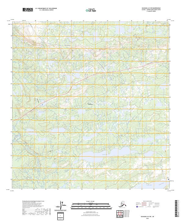
2023 Map of Gulkana A-5 SW
USGS Topo · Published 2023About this map
Mendeltna serves as the focal point of this Copper River Census Area terrain, situated along the Glenn Highway as it cuts across a landscape dominated by complex wetlands and numerous named lakes. The interior geography is defined by a dense network of water bodies, including Sucker Lake and the smaller Little Crater Lake, Junction Lake, and Tex Smith Lake. The southern portion of the map is anchored by the significant waters of Tazlina Lake and the Tazlina River, where the Indian Cem provides a direct connection to the area's indigenous heritage and burial traditions.
Find a feature on this map
23 named features on this map. Tap any name to fly to it.
Don’t see what you’re looking for? This feature index may not catch every label — zoom into the map to look around manually.
Map Details
Editions of this 2023 Gulkana A-5 SW Map
This is the sole edition of this map. No revisions or reprints were ever made.
Other maps of this area

1949 · Gulkana A-5
USGS Topo · 1:63,360

1949 · Gulkana A-6
USGS Topo · 1:63,360

1949 · Valdez D-6
USGS Topo · 1:63,360

1949 · Valdez D-7
USGS Topo · 1:63,360

1951 · Gulkana
USGS Topo · 1:250,000

1951 · Valdez D-6
USGS Topo · 1:63,360

1951 · Valdez D-7
USGS Topo · 1:63,360

1952 · Valdez
USGS Topo · 1:250,000

1952 · Gulkana A-5
USGS Topo · 1:63,360
1952 · Gulkana A-6
USGS Topo · 1:63,360