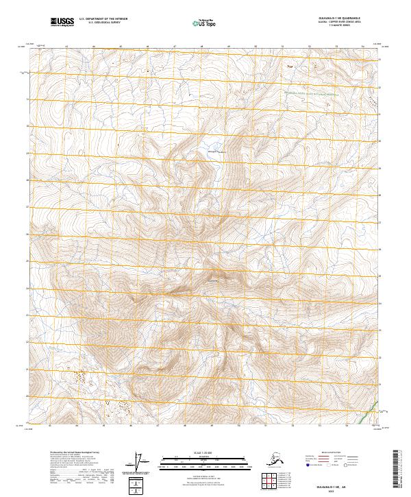
2023 Map of Gulkana B-1 NE
USGS Topo · Published 2023About this map
Wrangell Mountains dominate this high-altitude Alaskan landscape, where the peaks of Capital Mtn rise above a complex network of glacial drainages. This high country is largely protected within the Wrangell-St. Elias Wilderness and the adjacent Wrangell-Saint Elias National Preserve, illustrating the massive scale of conservation in the Copper River Census Area. The topography is defined by sharp elevation changes and the headwaters of alpine streams, including the seasonal flows of Boulder Creek and Sheep Creek. This 2023 survey provides a detailed record of the physical geography and public land boundaries at the intersection of several townships, including t8n r7e and t7n r7e, where the terrain remains largely untouched by infrastructure or permanent settlement.
Find a feature on this map
12 named features on this map. Tap any name to fly to it.
Don’t see what you’re looking for? This feature index may not catch every label — zoom into the map to look around manually.
Map Details
Editions of this 2023 Gulkana B-1 NE Map
This is the sole edition of this map. No revisions or reprints were ever made.
Other maps of this area

1948 · Nabesna C-6
USGS Topo · 1:63,360

1949 · Gulkana C-1
USGS Topo · 1:63,360

1950 · Nabesna
USGS Topo · 1:250,000

1951 · Gulkana
USGS Topo · 1:250,000

1951 · Nabesna
USGS Topo · 1:250,000

1952 · Nabesna C-6
USGS Topo · 1:63,360

1952 · Gulkana C-1
USGS Topo · 1:63,360

1959 · Gulkana B-1
USGS Topo · 1:63,360

1959 · Gulkana
USGS Topo · 1:250,000

1960 · Nabesna
USGS Topo · 1:250,000