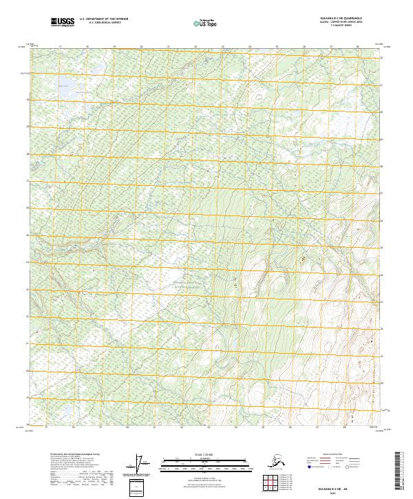
2023 Map of Gulkana B-2 NE
USGS Topo · Published 2023About this map
The Wrangell-Saint Elias National Preserve encompasses most of this landscape, showcasing the transition between subarctic wetlands and the rising slopes of the Wrangell Mountains. The terrain is defined by a dense network of marshes and water bodies in the northwest, including Billy Lake and the interconnected Yokneda Lakes. As the land moves southeast, the topography shifts into the protected boundaries of the Wrangell-St. Elias Wilderness. This survey illustrates the intricate drainage patterns and remote elevation changes within the Copper River Census Area, revealing a territory almost entirely devoid of human infrastructure or roads. The map highlights the vast scale of protected Alaskan wilderness, where the only identifiers are natural landmarks and public land survey system lines such as t8n r4e and t7n r5e.
Find a feature on this map
9 named features on this map. Tap any name to fly to it.
Don’t see what you’re looking for? This feature index may not catch every label — zoom into the map to look around manually.
Map Details
Editions of this 2023 Gulkana B-2 NE Map
This is the sole edition of this map. No revisions or reprints were ever made.
Other maps of this area

1949 · Gulkana C-2
USGS Topo · 1:63,360

1949 · Gulkana B-2
USGS Topo · 1:63,360

1949 · Gulkana C-1
USGS Topo · 1:63,360

1951 · Gulkana
USGS Topo · 1:250,000

1952 · Gulkana B-2
USGS Topo · 1:63,360

1952 · Gulkana C-2
USGS Topo · 1:63,360

1952 · Gulkana C-1
USGS Topo · 1:63,360

1959 · Gulkana B-1
USGS Topo · 1:63,360

1959 · Gulkana
USGS Topo · 1:250,000

1965 · Gulkana
USGS Topo · 1:250,000