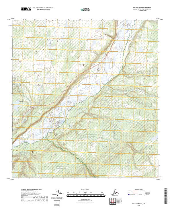
2023 Map of Gulkana B-2 NW
USGS Topo · Published 2023About this map
The Copper River dominates this interior Alaskan landscape, carving a wide alluvial path through the terrain south of Chistochina. The topography captures the transition from the river basin into the protected wilderness of Wrangell-Saint Elias National Park and the adjacent Wrangell-Saint-Elias National Preserve. These vast federal lands are defined by complex drainage systems, including the winding courses of Tulsona Creek and Little Tulsona Creek, which feed into the larger river system. Human infrastructure is limited to the corridor of the Tok Cutoff Highway in the northeast, providing a vital connection through this remote stretch of the Copper River Census Area. The map illustrates the sparsely settled nature of the region, where the natural hydrology and federal conservation boundaries dictate the land use patterns.
Find a feature on this map
12 named features on this map. Tap any name to fly to it.
Don’t see what you’re looking for? This feature index may not catch every label — zoom into the map to look around manually.
Map Details
Editions of this 2023 Gulkana B-2 NW Map
This is the sole edition of this map. No revisions or reprints were ever made.
Other maps of this area

1949 · Gulkana C-2
USGS Topo · 1:63,360

1949 · Gulkana B-2
USGS Topo · 1:63,360

1950 · Gulkana B-3
USGS Topo · 1:63,360

1950 · Gulkana C-3
USGS Topo · 1:63,360

1951 · Gulkana
USGS Topo · 1:250,000

1952 · Gulkana B-3
USGS Topo · 1:63,360

1952 · Gulkana B-2
USGS Topo · 1:63,360

1952 · Gulkana C-2
USGS Topo · 1:63,360
1952 · Gulkana C-3
USGS Topo · 1:63,360

1959 · Gulkana
USGS Topo · 1:250,000