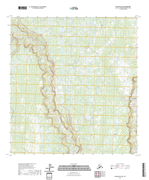
2023 Map of Gulkana B-3 NW
USGS Topo · Published 2023About this map
The Gulkana River and the Richardson Highway dominate this landscape, illustrating the critical transportation corridors that define this region of the Alaska interior. The highway roughly parallels the river’s path, providing essential access through a terrain marked by extensive wetlands and complex drainage patterns. Significant infrastructure, including the Alaska Pipeline and the historic Telegraph Cut Trail, demonstrates how different eras of transit and energy development have utilized this specific geographic passage. Small settlements like Chistochina and Gakona are positioned near the eastern edges of the quadrangle, where the Gakona River enters the frame. These locations serve as vital connection points between the wilderness and the roadway system, reflecting the sparse but strategic settlement patterns common in the Copper River census area.
Find a feature on this map
12 named features on this map. Tap any name to fly to it.
Don’t see what you’re looking for? This feature index may not catch every label — zoom into the map to look around manually.
Map Details
Editions of this 2023 Gulkana B-3 NW Map
This is the sole edition of this map. No revisions or reprints were ever made.
Other maps of this area

1950 · Gulkana B-3
USGS Topo · 1:63,360

1950 · Gulkana C-3
USGS Topo · 1:63,360

1950 · Gulkana C-4
USGS Topo · 1:63,360

1951 · Gulkana
USGS Topo · 1:250,000

1951 · Gulkana B-4
USGS Topo · 1:63,360

1952 · Gulkana B-3
USGS Topo · 1:63,360
1952 · Gulkana C-3
USGS Topo · 1:63,360
1952 · Gulkana B-4
USGS Topo · 1:63,360
1952 · Gulkana C-4
USGS Topo · 1:63,360

1959 · Gulkana
USGS Topo · 1:250,000