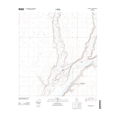
2013 Map of Gulkana B-3 SW
USGS Topo · Published 2013About this map
Gulkana River and Gakona River converge near the Copper River, forming a vital waterway network in this interior Alaskan landscape. The settlement of Gulkana lies at the intersection of the Richardson Hwy and the river, while Gakona Junction serves as the gateway to the Glenn Hwy Tok Cutoff. This survey illustrates a regional transportation hub where road, river, and air travel meet at the Jacobus Field Airport. To the east, the boundary of the Wrangell-Saint Elias National Preserve marks the transition into protected wilderness. Smaller local landmarks such as Big Timber and Gulkana River Ranch Rd indicate the established residential and ranching footprint of the early 21st century. The map provides a clear view of the topographical relationship between the braided river valleys and the high plateaus of the Unorganized Borough.
Find a feature on this map
17 named features on this map. Tap any name to fly to it.
Don’t see what you’re looking for? This feature index may not catch every label — zoom into the map to look around manually.
Map Details
Editions of this 2013 Gulkana B-3 SW Map
This is the sole edition of this map. No revisions or reprints were ever made.
Other maps of this area

1949 · Gulkana A-3
USGS Topo · 1:63,360

1950 · Gulkana B-3
USGS Topo · 1:63,360

1951 · Gulkana
USGS Topo · 1:250,000

1951 · Gulkana A-4
USGS Topo · 1:63,360

1951 · Gulkana B-4
USGS Topo · 1:63,360

1952 · Gulkana A-3
USGS Topo · 1:63,360

1952 · Gulkana B-3
USGS Topo · 1:63,360

1952 · Gulkana A-4
USGS Topo · 1:63,360
1952 · Gulkana B-4
USGS Topo · 1:63,360

1959 · Gulkana
USGS Topo · 1:250,000