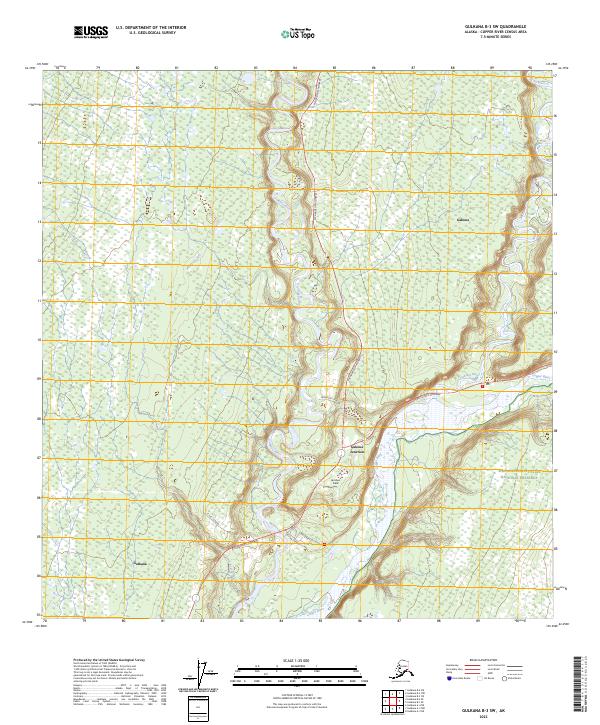
2023 Map of Gulkana B-3 SW
USGS Topo · Published 2023About this map
The confluence of the Gakona River and the Copper River defines this sub-arctic landscape, where highway infrastructure meets the vast protected wilderness of the Wrangell-Saint Elias National Preserve. The small settlements of Gulkana, Gakona, and Gakona Junction serve as vital hubs in the Copper River Basin, positioned along the historic transport corridors of the Richardson Highway and the Tok Cutoff Highway.
Find a feature on this map
20 named features on this map. Tap any name to fly to it.
Don’t see what you’re looking for? This feature index may not catch every label — zoom into the map to look around manually.
Map Details
Editions of this 2023 Gulkana B-3 SW Map
This is the sole edition of this map. No revisions or reprints were ever made.
Other maps of this area

1949 · Gulkana A-3
USGS Topo · 1:63,360

1950 · Gulkana B-3
USGS Topo · 1:63,360

1951 · Gulkana
USGS Topo · 1:250,000

1951 · Gulkana A-4
USGS Topo · 1:63,360

1951 · Gulkana B-4
USGS Topo · 1:63,360

1952 · Gulkana A-3
USGS Topo · 1:63,360

1952 · Gulkana B-3
USGS Topo · 1:63,360

1952 · Gulkana A-4
USGS Topo · 1:63,360
1952 · Gulkana B-4
USGS Topo · 1:63,360

1959 · Gulkana
USGS Topo · 1:250,000