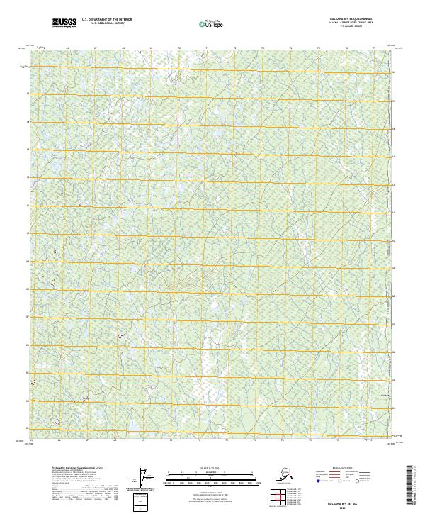
2023 Map of Gulkana B-4 SE
USGS Topo · Published 2023About this map
The Alaska Pipeline corridors through the eastern edge of this landscape, a defining piece of modern industrial infrastructure within the Copper River Census Area. This area, largely defined by the township and range lines of T7n R2w, T6n R2w, and their neighbors, represents the vast, wet terrain characteristic of the Gulkana region. The mapping reveals a complex network of small ponds and wetlands, illustrating the hydrological challenges and natural patterns of the Alaskan interior.
Find a feature on this map
7 named features on this map. Tap any name to fly to it.
Don’t see what you’re looking for? This feature index may not catch every label — zoom into the map to look around manually.
Map Details
Editions of this 2023 Gulkana B-4 SE Map
This is the sole edition of this map. No revisions or reprints were ever made.
Other maps of this area

1949 · Gulkana A-3
USGS Topo · 1:63,360

1950 · Gulkana B-3
USGS Topo · 1:63,360

1951 · Gulkana
USGS Topo · 1:250,000

1951 · Gulkana A-4
USGS Topo · 1:63,360

1951 · Gulkana B-4
USGS Topo · 1:63,360

1952 · Gulkana A-3
USGS Topo · 1:63,360

1952 · Gulkana B-3
USGS Topo · 1:63,360

1952 · Gulkana A-4
USGS Topo · 1:63,360
1952 · Gulkana B-4
USGS Topo · 1:63,360

1959 · Gulkana
USGS Topo · 1:250,000