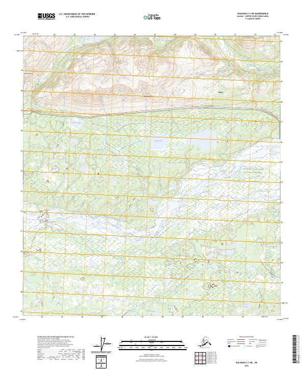
2023 Map of Gulkana C-1 NE
USGS Topo · Published 2023About this map
Slana and the surrounding wilderness of the Alaska Range dominate this interior landscape, where the Tok Cutoff Highway serves as the primary artery through the high country. The terrain transitions from the steep, creek-cut slopes of Chistochina in the north to the expansive wetlands and braided channels of the Copper River valley. This 2023 survey illustrates the complex hydrology of the region, featuring high-altitude water bodies like Grizzly Lake and the cluster of Cobb Lakes that feed into the larger river system.
Find a feature on this map
19 named features on this map. Tap any name to fly to it.
Don’t see what you’re looking for? This feature index may not catch every label — zoom into the map to look around manually.
Map Details
Editions of this 2023 Gulkana C-1 NE Map
This is the sole edition of this map. No revisions or reprints were ever made.
Other maps of this area

1948 · Nabesna C-6
USGS Topo · 1:63,360

1949 · Nabesna D-6
USGS Topo · 1:63,360

1949 · Gulkana C-1
USGS Topo · 1:63,360

1950 · Nabesna
USGS Topo · 1:250,000

1951 · Gulkana
USGS Topo · 1:250,000

1951 · Nabesna
USGS Topo · 1:250,000

1952 · Nabesna C-6
USGS Topo · 1:63,360

1952 · Nabesna D-6
USGS Topo · 1:63,360

1952 · Gulkana C-1
USGS Topo · 1:63,360
1954 · Gulkana D-1
USGS Topo · 1:63,360