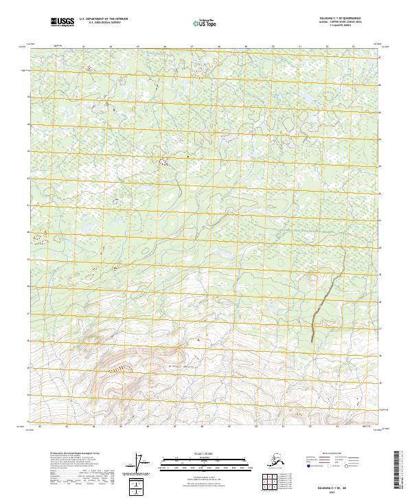
2023 Map of Gulkana C-1 SE
USGS Topo · Published 2023About this map
The Wrangell Mountains dominate the southern portion of this interior landscape, marking a transition from high-elevation peaks into the intricate wetland systems that define the Gulkana region. This 2023 survey delineates the boundary between the Wrangell-Saint Elias National Preserve and the protected lands of the Wrangell-St. Elias Wilderness. The terrain is characterized by a dense network of small water bodies and seasonal wetlands, typical of the copper river basin's topography. While devoid of modern development or named settlements, the map provides a precise look at the township and range lines, including t10n r7e and t9n r6e, which help ground this remote wilderness for researchers and land managers tracking environmental shifts in the Alaskan interior.
Find a feature on this map
10 named features on this map. Tap any name to fly to it.
Don’t see what you’re looking for? This feature index may not catch every label — zoom into the map to look around manually.
Map Details
Editions of this 2023 Gulkana C-1 SE Map
This is the sole edition of this map. No revisions or reprints were ever made.
Other maps of this area

1948 · Nabesna C-6
USGS Topo · 1:63,360

1949 · Gulkana C-1
USGS Topo · 1:63,360

1950 · Nabesna
USGS Topo · 1:250,000

1951 · Gulkana
USGS Topo · 1:250,000

1951 · Nabesna
USGS Topo · 1:250,000

1952 · Nabesna C-6
USGS Topo · 1:63,360

1952 · Gulkana C-1
USGS Topo · 1:63,360

1959 · Gulkana B-1
USGS Topo · 1:63,360

1959 · Gulkana
USGS Topo · 1:250,000

1960 · Nabesna
USGS Topo · 1:250,000