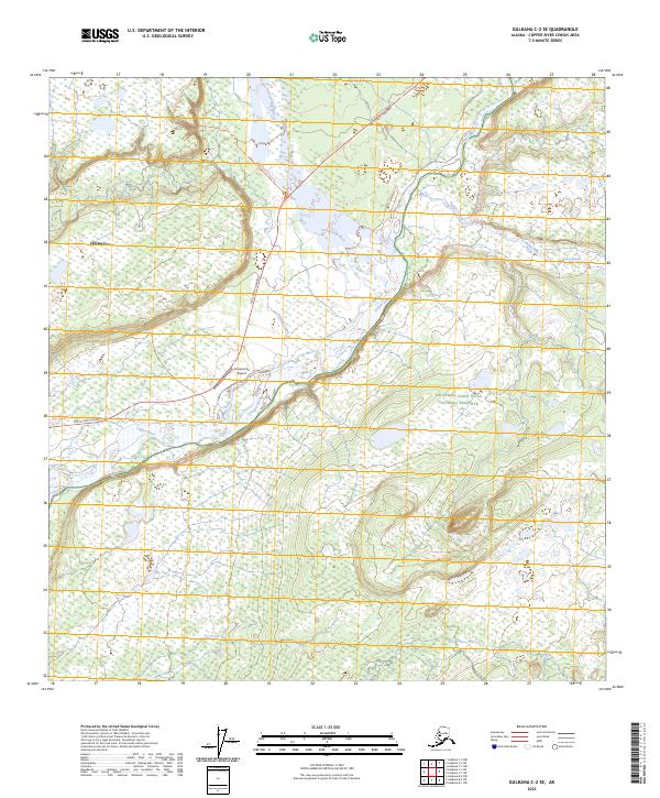
2023 Map of Gulkana C-2 SE
USGS Topo · Published 2023About this map
Chistochina sits at the confluence of glacial waters and human transit in this 2023 survey of the Copper River Basin. The landscape is defined by the braided path of the Copper River and its major tributary, the Chistochina River, which divide the terrain into low-lying wetlands and upland plateaus. This area serves as a critical gateway to the Alaskan interior, with the Tok Cutoff Highway providing the primary overland link while the Chistochina Airport maintains essential aerial access. The eastern portion of the map transitions into the protected wilderness of the Wrangell-Saint Elias National Preserve, where smaller waterways like Boulder Creek and Sinona Creek drain into the wider valley. The presence of the Chistochina River Trl indicates the persistence of local travel routes through the dense brush and river flats that characterize this subarctic environment.
Find a feature on this map
15 named features on this map. Tap any name to fly to it.
Don’t see what you’re looking for? This feature index may not catch every label — zoom into the map to look around manually.
Map Details
Editions of this 2023 Gulkana C-2 SE Map
This is the sole edition of this map. No revisions or reprints were ever made.
Other maps of this area

1949 · Gulkana C-2
USGS Topo · 1:63,360

1949 · Gulkana B-2
USGS Topo · 1:63,360

1949 · Gulkana C-1
USGS Topo · 1:63,360

1951 · Gulkana
USGS Topo · 1:250,000

1952 · Gulkana B-2
USGS Topo · 1:63,360

1952 · Gulkana C-2
USGS Topo · 1:63,360

1952 · Gulkana C-1
USGS Topo · 1:63,360

1959 · Gulkana B-1
USGS Topo · 1:63,360

1959 · Gulkana
USGS Topo · 1:250,000

1965 · Gulkana
USGS Topo · 1:250,000