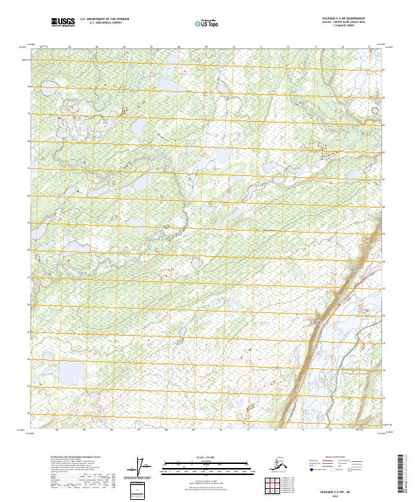
2023 Map of Gulkana C-2 SW
USGS Topo · Published 2023About this map
Chistochina sits at the heart of this interior Alaskan landscape, positioned where the braided channels of the Copper River meet the glacial drainage of the Copper River Basin. The map illustrates a transitional wilderness where the Tok Cutoff Highway provides the primary artery for transportation, following the lowlands between complex wetland systems. To the southeast, the terrain reaches into the Wrangell-Saint Elias National Preserve, a protected expanse that borders the river's eastern bank. A network of smaller waterways, including Fulsina Creek, Little Fulsina Creek, and Sinona Creek, carve through the spruce-laden flats, reflecting the dynamic hydrologic patterns of the region. The map captures the intersection of the Gulkana and Copper River drainages, highlighting the traditional and modern importance of this corridor for travel and subsistence.
Find a feature on this map
14 named features on this map. Tap any name to fly to it.
Don’t see what you’re looking for? This feature index may not catch every label — zoom into the map to look around manually.
Map Details
Editions of this 2023 Gulkana C-2 SW Map
This is the sole edition of this map. No revisions or reprints were ever made.
Other maps of this area

1949 · Gulkana C-2
USGS Topo · 1:63,360

1949 · Gulkana B-2
USGS Topo · 1:63,360

1950 · Gulkana B-3
USGS Topo · 1:63,360

1950 · Gulkana C-3
USGS Topo · 1:63,360

1951 · Gulkana
USGS Topo · 1:250,000

1952 · Gulkana B-3
USGS Topo · 1:63,360

1952 · Gulkana B-2
USGS Topo · 1:63,360

1952 · Gulkana C-2
USGS Topo · 1:63,360
1952 · Gulkana C-3
USGS Topo · 1:63,360

1959 · Gulkana
USGS Topo · 1:250,000