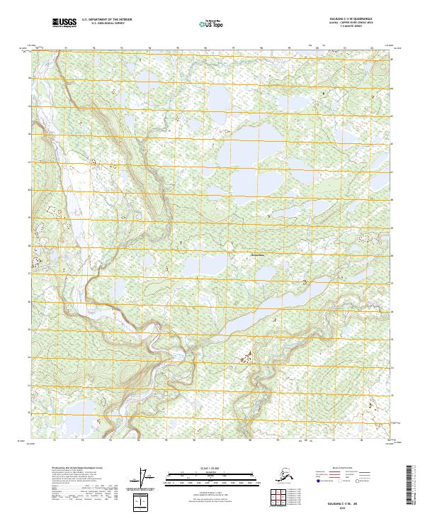
2023 Map of Gulkana C-3 SE
USGS Topo · Published 2023About this map
Chistochina sits at the heart of this Copper River Basin landscape, characterized by an intricate network of wetlands and small lakes typical of interior Alaska. The Gakona River meanders along the western edge of the quadrangle, carving a wide alluvial valley that contrasts with the surrounding upland terrain. Further east, Tulsona Creek winds through the lower reaches of the map, illustrating the complex hydrography of the region. The landscape is defined by the Public Land Survey System grids of t10n r1e, t10n r2e, t9n r1e, t9n r2e, t8n r1e, and t8n r2e, which provide a structured overlay to this otherwise untamed wilderness. This 2023 survey by the U.S. Geological Survey documents the modern state of the terrain, showing how water and topography define the layout of the land near the historic Gulkana region.
Find a feature on this map
9 named features on this map. Tap any name to fly to it.
Don’t see what you’re looking for? This feature index may not catch every label — zoom into the map to look around manually.
Map Details
Editions of this 2023 Gulkana C-3 SE Map
This is the sole edition of this map. No revisions or reprints were ever made.
Other maps of this area

1949 · Gulkana C-2
USGS Topo · 1:63,360

1949 · Gulkana B-2
USGS Topo · 1:63,360

1950 · Gulkana B-3
USGS Topo · 1:63,360

1950 · Gulkana C-3
USGS Topo · 1:63,360

1951 · Gulkana
USGS Topo · 1:250,000

1952 · Gulkana B-3
USGS Topo · 1:63,360

1952 · Gulkana B-2
USGS Topo · 1:63,360

1952 · Gulkana C-2
USGS Topo · 1:63,360
1952 · Gulkana C-3
USGS Topo · 1:63,360

1959 · Gulkana
USGS Topo · 1:250,000