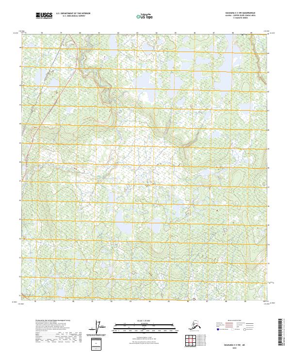
2023 Map of Gulkana C-3 SW
USGS Topo · Published 2023About this map
Sourdough Creek flows through this interior Alaskan landscape, which is defined by the massive infrastructure of the modern north and the remnants of earlier travel routes. The Alaska Pipeline and Richardson Highway dominate the western corridor, representing the primary arteries of industry and transport in the region. Adjacent to these modern landmarks, the Old Richardson Trl provides a clear view of the historical path used by earlier travelers before the modern highway was established. The map depicts a mosaic of wetlands and small water bodies characteristic of the Copper River basin, offering researchers a look at how contemporary energy infrastructure and transit lines navigate this complex hydrological environment.
Find a feature on this map
11 named features on this map. Tap any name to fly to it.
Don’t see what you’re looking for? This feature index may not catch every label — zoom into the map to look around manually.
Map Details
Editions of this 2023 Gulkana C-3 SW Map
This is the sole edition of this map. No revisions or reprints were ever made.
Other maps of this area

1950 · Gulkana B-3
USGS Topo · 1:63,360

1950 · Gulkana C-3
USGS Topo · 1:63,360

1950 · Gulkana C-4
USGS Topo · 1:63,360

1951 · Gulkana
USGS Topo · 1:250,000

1951 · Gulkana B-4
USGS Topo · 1:63,360

1952 · Gulkana B-3
USGS Topo · 1:63,360
1952 · Gulkana C-3
USGS Topo · 1:63,360
1952 · Gulkana B-4
USGS Topo · 1:63,360
1952 · Gulkana C-4
USGS Topo · 1:63,360

1959 · Gulkana
USGS Topo · 1:250,000