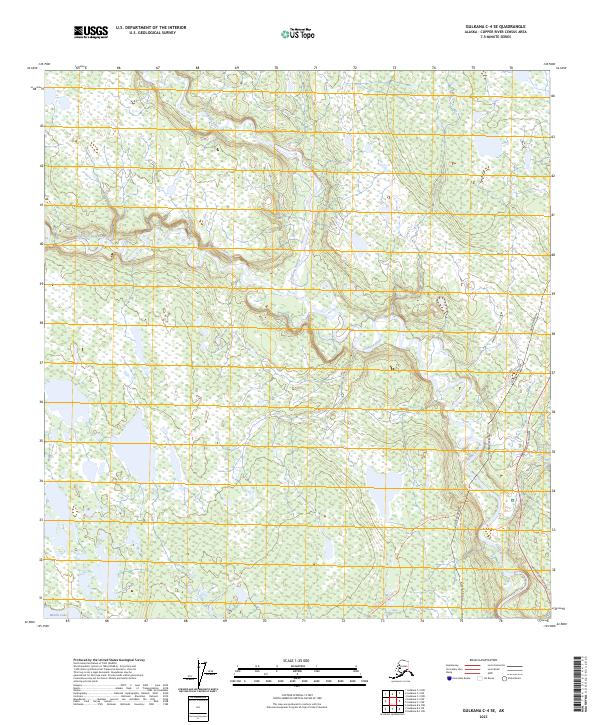
2023 Map of Gulkana C-4 SE
USGS Topo · Published 2023About this map
The Gulkana Wild and Scenic River carves a sinuous path through this Interior Alaska landscape, where the West Fork Gulkana River joins the main stem amidst a dense network of wetlands and small lakes. This 2023 survey illustrates the critical infrastructure corridor of the Copper River Census Area, notably where the Alaska Pipeline and the Richardson Highway parallel one another along the eastern edge of the quadrangle. The map reveals the relationship between modern transit routes and the natural terrain, preserved in the protected riparian corridor. While the river remains a focal point for recreation and natural history, the presence of the Sourdough Ewan Lake Trl and the proximity to Middle Lake highlight the area's continued importance for local access and subsistence.
Find a feature on this map
13 named features on this map. Tap any name to fly to it.
Don’t see what you’re looking for? This feature index may not catch every label — zoom into the map to look around manually.
Map Details
Editions of this 2023 Gulkana C-4 SE Map
This is the sole edition of this map. No revisions or reprints were ever made.
Other maps of this area

1950 · Gulkana B-3
USGS Topo · 1:63,360

1950 · Gulkana C-3
USGS Topo · 1:63,360

1950 · Gulkana C-4
USGS Topo · 1:63,360

1951 · Gulkana
USGS Topo · 1:250,000

1951 · Gulkana B-4
USGS Topo · 1:63,360

1952 · Gulkana B-3
USGS Topo · 1:63,360
1952 · Gulkana C-3
USGS Topo · 1:63,360
1952 · Gulkana B-4
USGS Topo · 1:63,360
1952 · Gulkana C-4
USGS Topo · 1:63,360

1959 · Gulkana
USGS Topo · 1:250,000