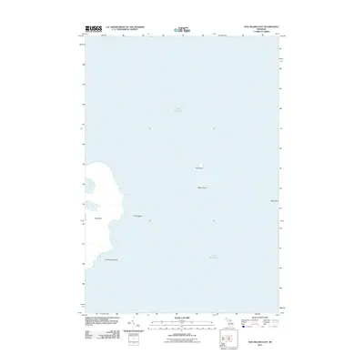
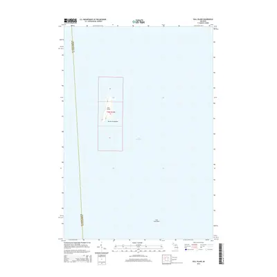
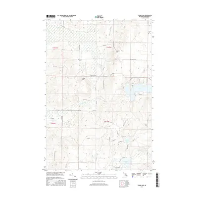
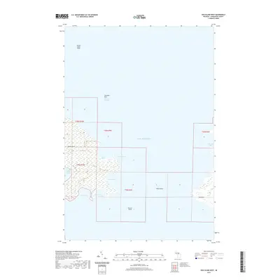
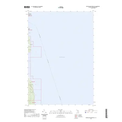
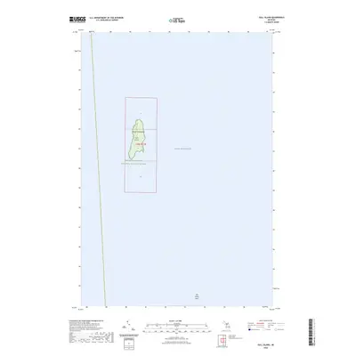
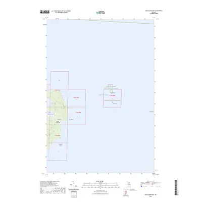
1955 Map of Gull Island
USGS Topo · Published 1979About this map
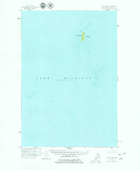
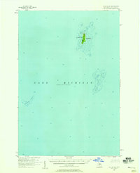
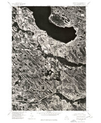
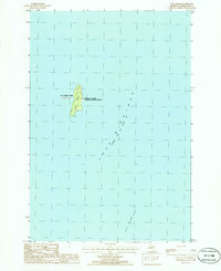
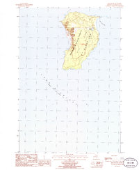
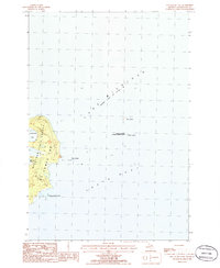
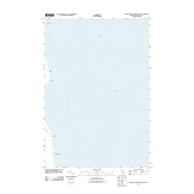
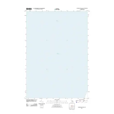
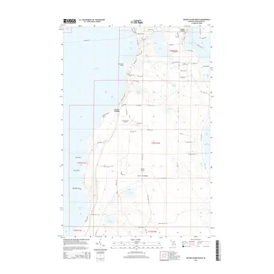
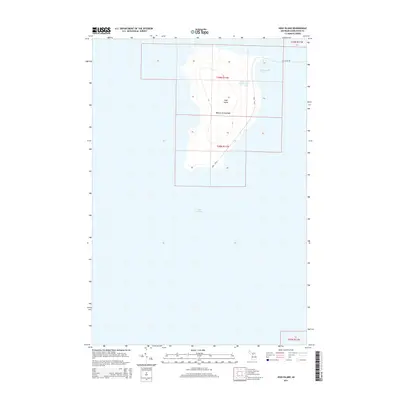
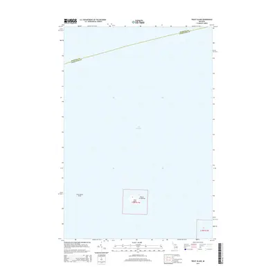
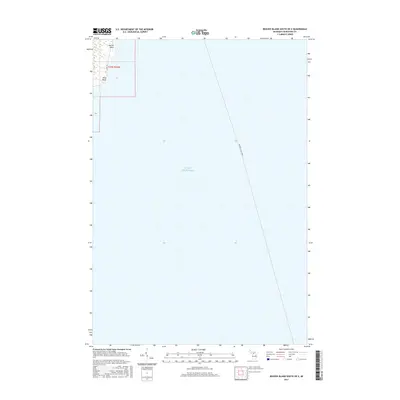
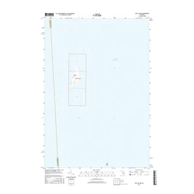
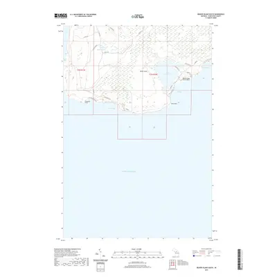
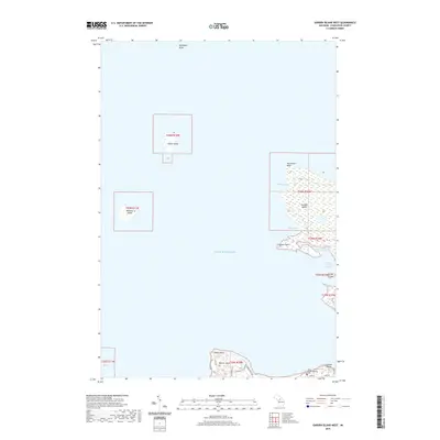
Gull Island and its surrounding waters dominate this mid-century hydrographic study of a remote reach within St James Twp. The map provides a detailed look at the island's isolation in Lake Michigan, marked only by a solitary Light on the northern shore and the small landform of South Gull to the south. The surrounding bathymetry reveals the treacherous underwater landscape that defined maritime navigation in this era, specifically the expansive Gull Island Reef and the isolated Boulder Reef to the southwest. This survey, compiled from aerial photography and lake charts, serves as a precise record of these natural hazards and the limited human footprint on these northern Michigan outposts before modern satellite navigation reshaped Great Lakes travel.
Find a feature on this map
7 named features on this map. Tap any name to fly to it.
Don’t see what you’re looking for? This feature index may not catch every label — zoom into the map to look around manually.
Map Details
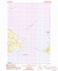
Editions of this 1955 Gull Island Map
2 editions found
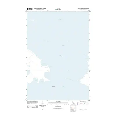
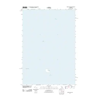
Historical Maps of Saint James Township Through Time
79 maps found
1955 Gull Island
Charlevoix County, MI
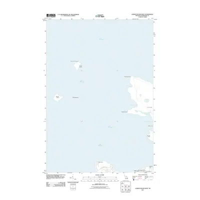
1956 Beaver Island
Charlevoix County, MI
1958 Bayshore
Charlevoix County, MI
1975 Boyne City NE
Charlevoix County, MI
1975 Boyne City NW
Charlevoix County, MI
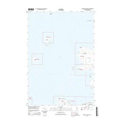
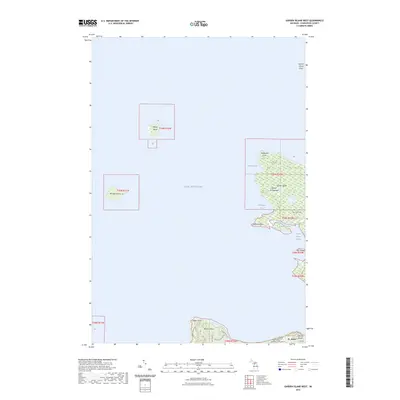
1980 Garden Island West
Charlevoix County, MI
1984 Beaver Island
Charlevoix County, MI
1986 Beaver Island North
Charlevoix County, MI
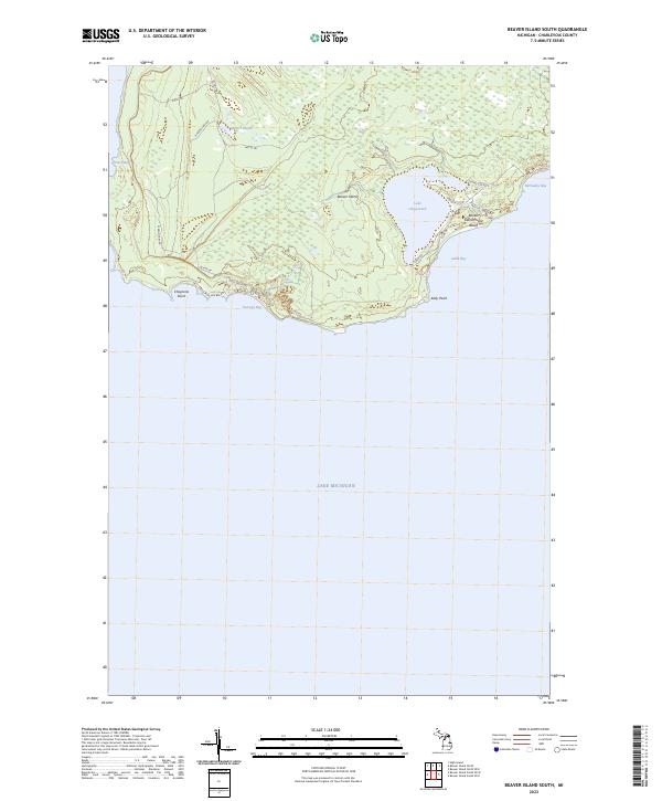
1986 Beaver Island South
Charlevoix County, MI
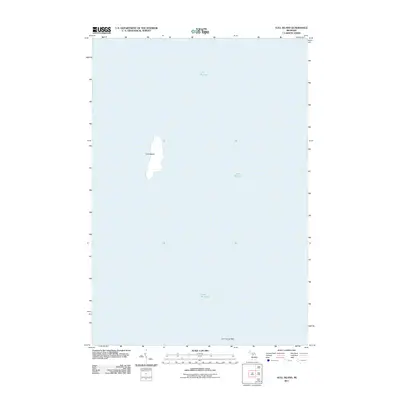
1986 Gull Island
Charlevoix County, MI
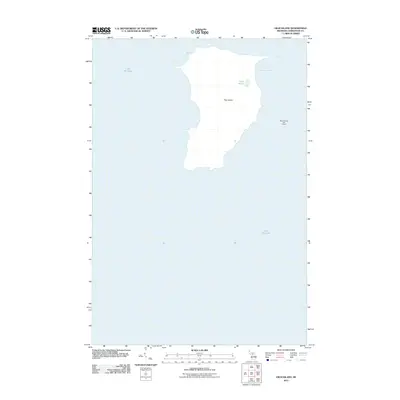
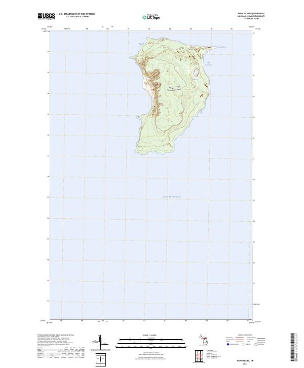
1986 High Island
Charlevoix County, MI
1986 Hog Island East
Charlevoix County, MI
1986 Hog Island West
Charlevoix County, MI
1986 Thumb Lake
Charlevoix County, MI
2011 Beaver Island North
Charlevoix County, MI
2011 Beaver Island North OE E
Charlevoix County, MI
2011 Beaver Island South
Charlevoix County, MI
2011 Beaver Island South OE E
Charlevoix County, MI
2011 Beaver Island South OE W
Charlevoix County, MI
2011 Charlevoix OE W
Charlevoix County, MI
2011 Garden Island West
Charlevoix County, MI
2011 Gull Island
Charlevoix County, MI
2011 High Island
Charlevoix County, MI
2011 Hog Island East
Charlevoix County, MI
2011 Hog Island West
Charlevoix County, MI
2011 Thumb Lake
Charlevoix County, MI
2011 Trout Island
Charlevoix County, MI
2014 Beaver Island North
Charlevoix County, MI
2014 Beaver Island North OE E
Charlevoix County, MI
2014 Beaver Island South
Charlevoix County, MI
2014 Beaver Island South OE E
Charlevoix County, MI
2014 Beaver Island South OE W
Charlevoix County, MI
2014 Charlevoix OE W
Charlevoix County, MI
2014 Garden Island West
Charlevoix County, MI
2014 Gull Island
Charlevoix County, MI
2014 High Island
Charlevoix County, MI
2014 Hog Island East
Charlevoix County, MI
2014 Hog Island West
Charlevoix County, MI
2014 Thumb Lake
Charlevoix County, MI
2014 Trout Island
Charlevoix County, MI
2017 Beaver Island North
Charlevoix County, MI
2017 Beaver Island North OE E
Charlevoix County, MI
2017 Beaver Island South
Charlevoix County, MI
2017 Beaver Island South OE E
Charlevoix County, MI
2017 Beaver Island South OE W
Charlevoix County, MI
2017 Charlevoix OE W
Charlevoix County, MI
2017 Garden Island West
Charlevoix County, MI
2017 Gull Island
Charlevoix County, MI
2017 High Island
Charlevoix County, MI
2017 Hog Island East
Charlevoix County, MI
2017 Hog Island West
Charlevoix County, MI
2017 Thumb Lake
Charlevoix County, MI
2017 Trout Island
Charlevoix County, MI
2019 Beaver Island North
Charlevoix County, MI
2019 Beaver Island North OE E
Charlevoix County, MI
2019 Beaver Island South
Charlevoix County, MI
2019 Beaver Island South OE E
Charlevoix County, MI
2019 Beaver Island South OE W
Charlevoix County, MI
2019 Charlevoix OE W
Charlevoix County, MI
2019 Garden Island West
Charlevoix County, MI
2019 Gull Island
Charlevoix County, MI
2019 High Island
Charlevoix County, MI
2019 Hog Island East
Charlevoix County, MI
2019 Hog Island West
Charlevoix County, MI
2019 Thumb Lake
Charlevoix County, MI
2019 Trout Island
Charlevoix County, MI
2023 Beaver Island North
Charlevoix County, MI
2023 Beaver Island North OE E
Charlevoix County, MI
2023 Beaver Island South
Charlevoix County, MI
2023 Beaver Island South OE E
Charlevoix County, MI
2023 Beaver Island South OE W
Charlevoix County, MI
2023 Charlevoix OE W
Charlevoix County, MI
2023 Garden Island West
Charlevoix County, MI
2023 Gull Island
Charlevoix County, MI
2023 High Island
Charlevoix County, MI
2023 Hog Island East
Charlevoix County, MI
2023 Hog Island West
Charlevoix County, MI
2023 Thumb Lake
Charlevoix County, MI
2023 Trout Island
Charlevoix County, MI