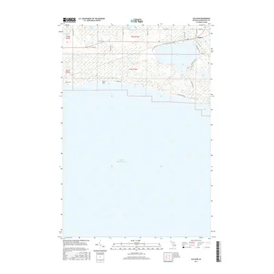
2017 Map of Gulliver
USGS Topo · Published 2017About this map
Gulliver Lake and its surrounding wetlands dominate this coastal reach of the Upper Peninsula, where the waters drain south toward the vast expanse of Lake Michigan. The settlement of Gulliver serves as the central hub of this landscape, situated near the intersection of several local routes like N Gulliver Rd and Old US Hwy 2. The map illustrates a high density of small inland water bodies, including Little Muddy Lake, Anderson Lake, and Palmer Lake, suggesting a terrain shaped by post-glacial hydrology and cedar swamps.
Find a feature on this map
38 named features on this map. Tap any name to fly to it.
Don’t see what you’re looking for? This feature index may not catch every label — zoom into the map to look around manually.
Map Details
Editions of this 2017 Gulliver Map
This is the sole edition of this map. No revisions or reprints were ever made.
Other maps of this area

1931 · Seul Choix Point NW
USGS Topo · 1:31,680

1931 · Manistique River SE
USGS Topo · 1:31,680

1931 · Blaney SW
USGS Topo · 1:31,680

1931 · Manistique River SW
USGS Topo · 1:31,680

1954 · Escanaba
USGS Topo · 1:250,000

1954 · Sault Sainte Marie
USGS Topo · 1:250,000

1955 · Cheboygan
USGS Topo · 1:250,000

1956 · Sault Sainte Marie
USGS Topo · 1:250,000

1957 · Escanaba
USGS Topo · 1:250,000

1957 · Sault Sainte Marie
USGS Topo · 1:250,000