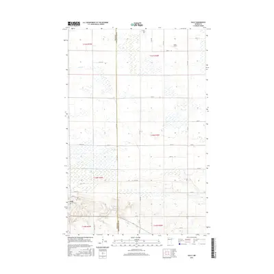
2016 Map of Gully
USGS Topo · Published 2016About this map
Gully lies in the southwestern corner of this survey, established at the intersection of Co Rd 2 and Co Hwy 48. The surrounding landscape is defined by the Polk Co and Clearwater Co boundary, which bisects the region north-to-south. To the north, the Lost River meanders through a low-lying area filled with wetlands, while the County Ditch Number Eighty Nine represents the extensive drainage efforts common to this part of Minnesota. Local history is anchored by the Gully Cem and the more isolated Oak Grove Cem to the north, while the Mathis Airport serves as a small aviation landmark in the northeastern portion of the quadrangle.
Find a feature on this map
31 named features on this map. Tap any name to fly to it.
Don’t see what you’re looking for? This feature index may not catch every label — zoom into the map to look around manually.
Map Details
Editions of this 2016 Gully Map
This is the sole edition of this map. No revisions or reprints were ever made.
Other maps of this area
1919 · Fosston
USGS Topo · 1:62,500
1919 · Churnes
USGS Topo · 1:62,500
1919 · Winsor
USGS Topo · 1:62,500
1943 · Bagley
USGS Topo · 1:62,500

1954 · Bemidji
USGS Topo · 1:250,000

1957 · Bemidji
USGS Topo · 1:250,000

1958 · Bemidji
USGS Topo · 1:250,000
1969 · Olga
USGS Topo · 1:24,000
1969 · Clearbrook
USGS Topo · 1:24,000
1969 · Gonvick
USGS Topo · 1:24,000