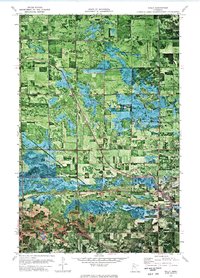
1972 Map of Gully
USGS Topo · Published 1976About this map
Gully serves as the primary settlement on this orthophotomap, which utilizes 1969 aerial photography to reveal the agricultural and hydrologic patterns of northern Minnesota. The landscape is defined by the winding course of the Lost River and the extensive marshlands protected within the Le Blanc State Wildlife Management Area. This 1972 survey captures the intersection of natural watercourses and human infrastructure, including the straight-cut line of County Ditch No 49 and a major Pipeline cutting diagonally across the township boundaries. Genealogists will find the Oak Grove Cem and an additional Cem in Johnson township, while researchers can trace the rural property divisions across Winsor, Hansgard, and EDENEden townships. The map's photographic base provides an exceptionally clear view of the field boundaries and woodlots during the early 1970s.
Find a feature on this map
15 named features on this map. Tap any name to fly to it.
Don’t see what you’re looking for? This feature index may not catch every label — zoom into the map to look around manually.
Map Details
Editions of this 1972 Gully Map
This is the sole edition of this map. No revisions or reprints were ever made.
Other maps of this area

1919 · Fosston
USGS Topo · 1:62,500

1919 · Churnes
USGS Topo · 1:62,500

1919 · Winsor
USGS Topo · 1:62,500

1943 · Bagley
USGS Topo · 1:62,500

1954 · Bemidji
USGS Topo · 1:250,000

1957 · Bemidji
USGS Topo · 1:250,000

1958 · Bemidji
USGS Topo · 1:250,000

1969 · Olga
USGS Topo · 1:24,000

1969 · Clearbrook
USGS Topo · 1:24,000

1969 · Gonvick
USGS Topo · 1:24,000