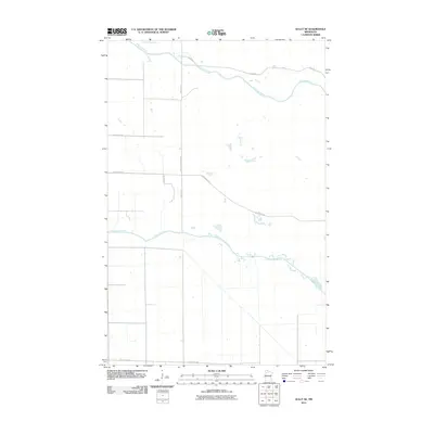
2010 Map of Gully NE
USGS Topo · Published 2010About this map
The Red Lake Reservation defines the central and northern boundary of this Polk County landscape, where the meandering course of the Red Lake River flows westward through a strictly gridded agricultural interior. The terrain is marked by the distinct hydraulic geometry of the Clearwater River, which cuts across the southern portion of the quadrangle. The map reveals a rural infrastructure built around a systematic section line road network, including arterial routes like County Hwy 51 and County Hwy 52. Named local thoroughfares such as Sayersville Rd and Rickery Dr provide access to the dispersed farmsteads and individual property plots that characterize this corner of northern Minnesota. This digital survey from the early 21st century documents the precise intersection of tribal lands and county-maintained rural development.
Find a feature on this map
10 named features on this map. Tap any name to fly to it.
Don’t see what you’re looking for? This feature index may not catch every label — zoom into the map to look around manually.
Map Details
Editions of this 2010 Gully NE Map
This is the sole edition of this map. No revisions or reprints were ever made.
Other maps of this area

1918 · Jelle
USGS Topo · 1:62,500

1919 · Churnes
USGS Topo · 1:62,500

1919 · Winsor
USGS Topo · 1:62,500

1954 · Bemidji
USGS Topo · 1:250,000

1954 · Roseau
USGS Topo · 1:250,000

1957 · Roseau
USGS Topo · 1:250,000

1957 · Bemidji
USGS Topo · 1:250,000

1958 · Bemidji
USGS Topo · 1:250,000

1958 · Roseau
USGS Topo · 1:250,000

1972 · Erie
USGS Topo · 1:24,000