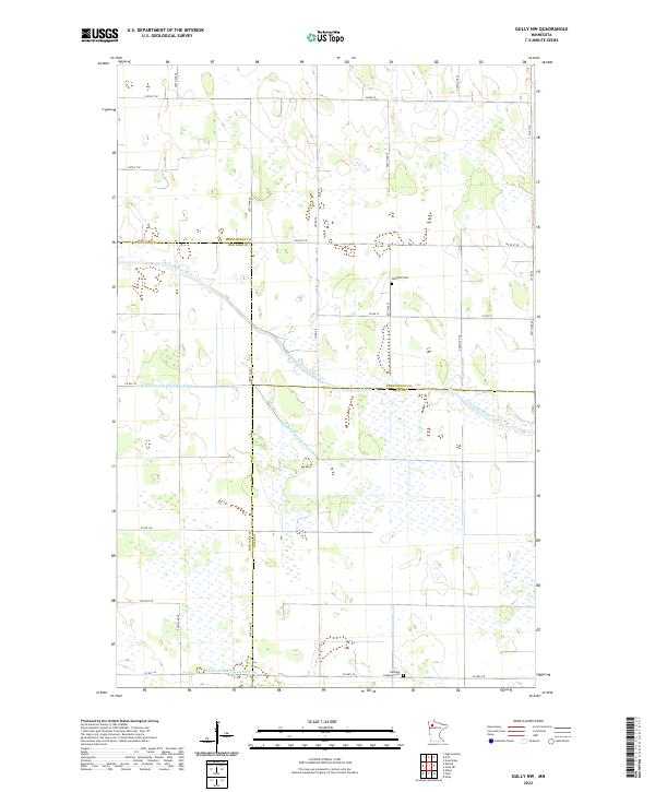
2022 Map of Gully NW
USGS Topo · Published 2022About this map
The Clearwater River meanders across this northern Minnesota landscape, marking a boundary where the flat agricultural plains of Pennington County meet Red Lake County and Polk County. This 2022 survey reveals a terrain defined by water management and rural tradition, dominated by a network of engineered waterways such as Judicial Ditch Number One and Judicial Ditch Number Three that drain the local wetlands for farming. Local history is anchored by modest landmarks like the Nazareth Cem and Bethany Lutheran Cem, which stand as quiet markers of the communities that settled these townships. The map illustrates a strictly rectilinear section-line road system, featuring routes like Co Rd 54 and Co Rd 1, reflecting the enduring influence of the Public Land Survey System on the region’s development.
Find a feature on this map
33 named features on this map. Tap any name to fly to it.
Don’t see what you’re looking for? This feature index may not catch every label — zoom into the map to look around manually.
Map Details
Editions of this 2022 Gully NW Map
This is the sole edition of this map. No revisions or reprints were ever made.
Other maps of this area

1919 · Grit
USGS Topo · 1:62,500

1919 · Winsor
USGS Topo · 1:62,500

1954 · Bemidji
USGS Topo · 1:250,000

1954 · Roseau
USGS Topo · 1:250,000

1957 · Roseau
USGS Topo · 1:250,000

1957 · Bemidji
USGS Topo · 1:250,000

1958 · Bemidji
USGS Topo · 1:250,000

1958 · Roseau
USGS Topo · 1:250,000
1971 · Oklee
USGS Topo · 1:24,000
1971 · Roland
USGS Topo · 1:24,000