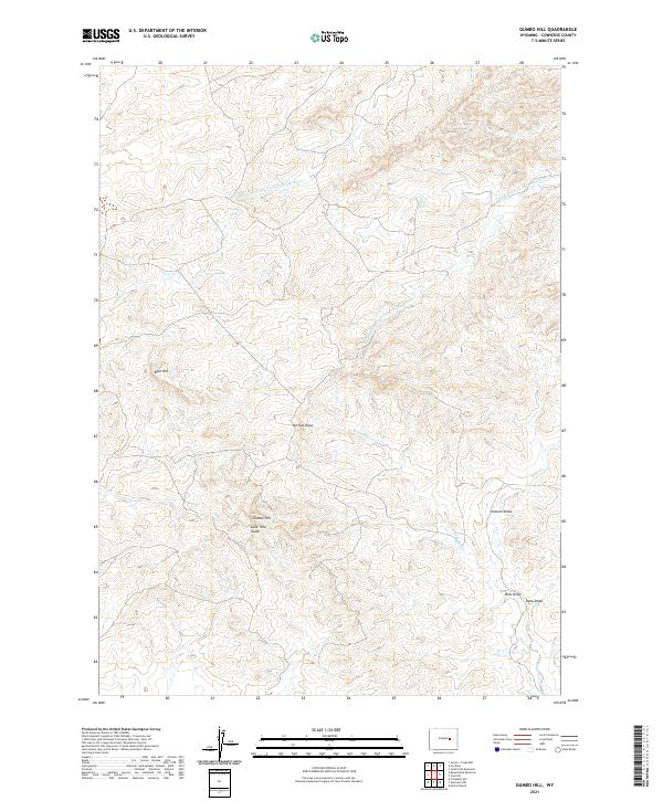
2021 Map of Gumbo Hill
USGS Topo · Published 2021About this map
Gumbo Hill stands as a central high point in this portion of Converse County, where the high plains are carved by a complex network of ephemeral drainages. The landscape is defined by the branching headwaters of the Cheyenne River system, including the Middle Fork Dry Fork Cheyenne River and the S Fork Dry Fork Cheyenne River. These seasonal watercourses, along with named features like Lone Tree Gulch and Derrick Draw, suggest a terrain historically utilized for open-range ranching and resource extraction. The absence of concentrated settlements highlights the sparse, rural nature of this Wyoming territory, where landmarks such as Blue Hill and Ordurm Draw provide the primary orientation for those navigating the wide-open township and range blocks of the t36n r76w and t36n r75w grids.
Find a feature on this map
17 named features on this map. Tap any name to fly to it.
Don’t see what you’re looking for? This feature index may not catch every label — zoom into the map to look around manually.
Map Details
Editions of this 2021 Gumbo Hill Map
This is the sole edition of this map. No revisions or reprints were ever made.
Other maps of this area

1949 · Campbell Hill
USGS Topo · 1:24,000

1949 · Glenrock NW
USGS Topo · 1:24,000

1949 · Hylton Ranch
USGS Topo · 1:24,000

1950 · Campbell Hill
USGS Topo · 1:24,000

1950 · Glenrock NW
USGS Topo · 1:24,000
1950 · Hylton Ranch
USGS Topo · 1:24,000

1954 · Torrington
USGS Topo · 1:250,000

1955 · Newcastle
USGS Topo · 1:250,000

1955 · Arminto
USGS Topo · 1:250,000

1955 · Casper
USGS Topo · 1:250,000