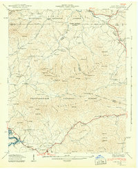
1942 Map of Gumlog
USGS Topo · Published 1942About this map
Blairsville anchors the southern portion of this 1941 field study, which captures the mountain borderlands of Georgia and North Carolina during a period of significant hydroelectric development. The landscape is defined by the sharp ridges of Ivylog Mountain and Gumlog Mountain, with the recently formed Nottely Reservoir beginning to flood the lowlands. The presence of blue-stippled areas indicates land planned for submergence, a visual record of the era's transformation of the Nottely River valley.
Find a feature on this map
109 named features on this map. Tap any name to fly to it.
Don’t see what you’re looking for? This feature index may not catch every label — zoom into the map to look around manually.
Map Details
Editions of this 1942 Gumlog Map
2 editions found
Other maps of this area

1886 · Dahlonega
USGS Topo · 1:125,000

1888 · Ellijay
USGS Topo · 1:125,000

1892 · Dahlonega
USGS Topo · 1:125,000

1892 · Ellijay
USGS Topo · 1:125,000

1893 · Murphy
USGS Topo · 1:125,000

1896 · Dahlonega
USGS Topo · 1:125,000

1898 · Ellijay
USGS Topo · 1:125,000

1903 · Dahlonega
USGS Topo · 1:125,000

1911 · Ellijay
USGS Topo · 1:125,000

1914 · Murphy
USGS Topo · 1:125,000